Ukrainian military warns of Russian tactical aviation activity and guided aerial weapon threat in Zaporizhzhia
What happened
On 23 October 2026 at about 08:14 UTC, the Telegram channel of the Ukrainian Air Force (@kpszsu) posted a warning of enemy tactical aviation activity in the southern direction and a threat of aerial weapons being used against frontline oblasts. The original Ukrainian text uses an alert banner and rocket symbols to signal danger, but it does not name specific aircraft, munitions, or targets. The alert is tagged to Zaporizhzhia, Ukraine, though the wording refers to frontline oblasts more broadly. No casualties, impacts, or damage are described in the report. The post is categorised as a siren-type air alert rather than a confirmed strike.
Context and assessment
Zaporizhzhia sits close to the front line in southern Ukraine, and the city and surrounding oblast have repeatedly been exposed to long-range drone activity and glide-bomb attacks. The alert fits a pattern visible in the related events. Earlier on 22 October, single Shahed-type drones were logged over the city, and in the early hours of 23 October a group of two or more jet-powered Geran-3 drones was reported over Zaporizhzhia. Shortly before the alert, a Russian guided glide bomb was reported heading toward Zaporizhzhya Oblast, and about six hours earlier tactical aircraft were reported moving toward the same oblast. Taken together, the sequence suggests a sustained effort to combine aerial strike systems with guided munitions against frontline areas. Operationally, a warning of this kind is typically intended to prompt shelter and to signal that aircraft may be preparing to launch standoff weapons, though the post itself does not confirm launch or intent.
Sources and confidence
The report rests on a single channel, the official Telegram account of the Ukrainian Air Force, which carries the source tag Telegram (@kpszsu). No independent outlet or second channel has been identified in the provided data to confirm the warning. The confidence score of 8.0 reflects that the originator is an official military source with a consistent record of air alerts, while the single-source status and the generic wording limit it. Confidence would rise with corroboration from regional Ukrainian authorities, reports of impacts or interceptions, or matching monitoring data from other channels. It would fall if subsequent official updates retracted or revised the alert.
Location
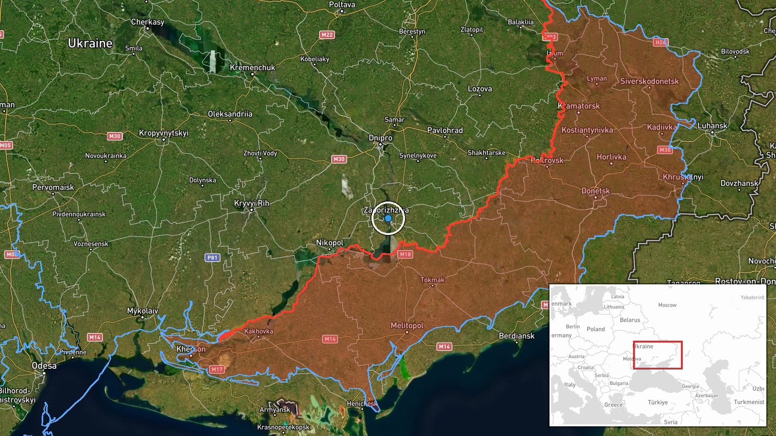
The location is recorded at region level, Zaporizhzhia, Ukraine, with coordinates near 47.84 N, 35.14 E, which correspond to the city of Zaporizhzhia rather than a specific facility. The warning refers to frontline oblasts, so the point marks the wider area of concern rather than a confirmed target. Zaporizhzhia lies on the Dnipro River in southeastern Ukraine, near the Kakhovka reservoir area and the southern front, and the surrounding oblast is largely flat steppe.
Related events nearby
- Ukrainian air monitoring: 2+ Russian jet-powered Shahed (Geran-3) drones over Zaporizhzhia.2026-10-23 02:16 UTC · Drone Transit · Zaporizhzhia, Ukraine
- Ukrainian air monitoring: 1 Russian Shahed-type drone heading toward Zaporizhzhia.2026-10-22 17:01 UTC · Drone Transit · Zaporizhzhia, Ukraine
- Ukrainian air monitoring: 1 Russian Shahed-type drone over Zaporizhzhia.2026-10-22 16:59 UTC · Drone Transit · Zaporizhzhia, Ukraine
- Ukrainian air monitoring: 1 Russian guided glide bomb (KAB) heading toward Zaporizhzhya Oblast.2026-10-23 08:06 UTC · Airstrike · Zaporizhzhya Oblast, Ukraine
- Ukrainian air monitoring: Russian tactical aircraft (tac. aviation) heading toward Zaporizhzhya Oblast.2026-10-23 01:50 UTC · Combat Aircraft · Zaporizhzhya Oblast, Ukraine
▶ View this event on the live map

Intel Mapper aggregates open-source reports from monitored Telegram and X channels, geolocates them, cross-checks duplicates across sources and assigns a confidence score. Entries are updated as new confirmations arrive. Read how we verify events.