Jet-powered Shahed drones reported over Zaporizhzhia city, Ukrainian air monitoring says
What happened
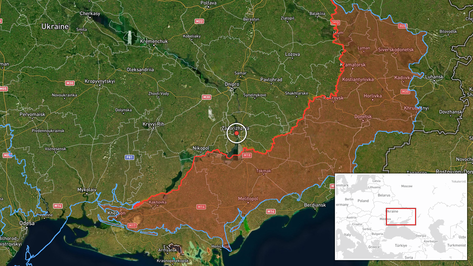
Ukraine's Telegram channel @kpszsu, which carries official Ukrainian air-threat warnings, reported at 02:16 UTC on 23 October 2026 that two or more jet-powered drones, identified as Russian Shahed-series Geran-3 types, were flying over the city of Zaporizhzhia in southeastern Ukraine. The original Ukrainian post was brief. It named Zaporizhzhia, described jet-powered UAVs over the city, and told residents to take shelter. The report does not state any impact, casualties, or interceptions. The event is recorded as a drone transit rather than a confirmed strike. Because only one channel published it, the report is treated as a single-source alert. Its wording describes reported presence and an air-threat warning, so the phrase over the city does not by itself confirm targeting.
Context and assessment
Zaporizhzhia has been a recurring focus of the southern front, and the city sits on the Dnipro River, with the Zaporizhzhia nuclear power plant to the southwest near Enerhodar, which adds weight to air alerts in the region. The surrounding pattern on 22 and 23 October shows a sequence rather than a single incident. At 16:59 and 17:01 UTC on 22 October, Ukrainian air monitoring logged a single Shahed-type drone over the city and another heading toward it. At the same 17:01 timestamp, two or more Geran-3 jet-powered drones were reported passing Slavhorod and heading west, suggesting a stream of aircraft moving across central Ukraine toward the southeast. Earlier, at 01:50 UTC on 23 October, a Russian tactical aircraft was reported heading toward Zaporizhzhya Oblast. Ground fighting on the Orikhiv axis near Lukianivske and Pavlivka was also reported by the General Staff the previous evening. Operationally, a rising count of jet-powered drones over one city within hours may indicate a saturation attack, a reconnaissance pass, or a route toward other targets, though the data alone cannot distinguish between these possibilities or identify intended targets.
Sources and confidence
The event rests on one Telegram channel, @kpszsu, which carries official Ukrainian air-threat warnings. No independent outlet, wire service, or second channel in the dataset confirms the sighting, and the related events come from the same air-monitoring stream. The confidence score of 8.0 reflects the channel's official role and specific wording, offset by the absence of cross-confirmation and the brief, unquantified report. Confidence would rise with corroboration from regional authorities or debris reports, and fall if updates revise the aircraft identification or withdraw the alert.
Location
The location is settlement-level, placed at the approximate centre of Zaporizhzhia city (47.84 N, 35.14 E) with high location confidence, and no facility-level precision is claimed. Zaporizhzhia lies on the Dnipro River in south-eastern Ukraine. The Zaporizhzhia nuclear power plant is to the southwest near Enerhodar, and Orikhiv lies further southwest along the front-facing axis referenced in related reports.
Related events nearby
- Ukrainian air monitoring: 1 Russian Shahed-type drone heading toward Zaporizhzhia.2026-10-22 17:01 UTC · Drone Transit · Zaporizhzhia, Ukraine
- Ukrainian air monitoring: 1 Russian Shahed-type drone over Zaporizhzhia.2026-10-22 16:59 UTC · Drone Transit · Zaporizhzhia, Ukraine
- Ukrainian air monitoring: Russian tactical aircraft (tac. aviation) heading toward Zaporizhzhya Oblast.2026-10-23 01:50 UTC · Combat Aircraft · Zaporizhzhya Oblast, Ukraine
- Ukrainian General Staff reports two Russian combat clashes on the Orikhiv axis near Lukianivske and Pavlivka a2026-10-22 19:05 UTC · Combat · Lukianivske, Orikhiv Raion, Zaporizhzhia Oblast, U
- Ukrainian air monitoring: 2+ Russian jet-powered Shahed (Geran-3) drones passing Slavhorod, heading west.2026-10-22 17:01 UTC · Drone Transit · Slavhorod, Ukraine
▶ View this event on the live map

Intel Mapper aggregates open-source reports from monitored Telegram and X channels, geolocates them, cross-checks duplicates across sources and assigns a confidence score. Entries are updated as new confirmations arrive. Read how we verify events.