Jet-powered Shahed (Geran-3) drone reported heading toward Vilnyansk, Zaporizhzhia Oblast
What happened
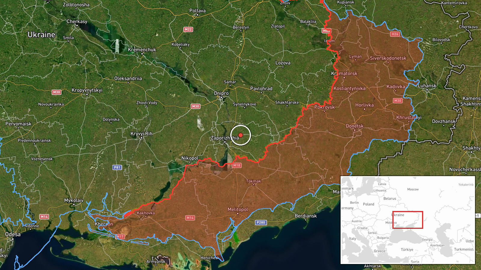
Ukrainian air monitoring, relayed through the Telegram channel @kpszsu, reported one Russian jet-powered Shahed, identified as a Geran-3, heading toward Vilnyansk in Zaporizhzhia Oblast from the south. The report is timestamped 23 October 2026 at 08:45 UTC. The original Ukrainian-language post describes a jet-type UAV (реактивний БпЛА) moving on Vilnyansk from the south, and the English summary refers to a drone 'heading toward' the town. This wording describes a track, not a confirmed impact. The report describes no strike, casualties, or damage at Vilnyansk. It is a single-channel air-alert item, so it documents an aerial track in the area rather than an outcome on the ground.
Context and assessment
Vilnyansk lies northwest of the city of Zaporizhzhia, and the oblast has seen repeated Russian air activity over the past two days. Earlier on 22 October, a monitoring report described two or more Geran-3 drones passing Slavhorod and heading west, and a separate item that day recorded a Shahed-type drone heading toward Zaporizhzhia city. Early on 23 October, drones were reported over Zaporizhzhia city at 02:16, and tactical aviation was reported heading toward the oblast at 01:50. A guided glide bomb (KAB) heading toward Zaporizhzhya Oblast was reported at 08:06, about forty minutes before the Vilnyansk track. Taken together, the sequence suggests a sustained effort to probe or saturate air defences across the oblast, combining drones with glide bombs and aircraft. A single drone heading toward a smaller settlement may reflect a routing choice, a decoy or a diversion from another axis, but the available reports do not establish intent. Any operational reading should remain provisional until follow-up reporting clarifies targets.
Sources and confidence
The event rests on one Telegram channel, @kpszsu, which is the official Ukrainian air-force-linked monitoring account and is generally regarded as a primary source for air-alert tracking. No second channel or independent outlet is listed as confirming the Vilnyansk track. The confidence score of 8.0 reflects the official origin and clear wording, offset by the single-source status and the absence of any impact or follow-up reporting. Confidence would rise with corroboration from another monitoring channel, regional military administration statements, or imagery of debris or impact at Vilnyansk. It would fall if later updates reassign the track or show it was not directed at the town.
Location
The location is recorded at settlement level, with high location confidence, using coordinates for Vilnyansk itself rather than a specific facility. The town sits in Zaporizhzhia Oblast in south-eastern Ukraine. The surrounding terrain is largely open steppe, cut by river valleys and reservoir shorelines associated with the Dnipro basin. The coordinates are a reasonable centroid for the settlement, but a drone track toward the town could end anywhere within the surrounding area.
Related events nearby
- Ukrainian air monitoring: 2+ Russian jet-powered Shahed (Geran-3) drones passing Slavhorod, heading west.2026-10-22 17:01 UTC · Drone Transit · Slavhorod, Ukraine
- Ukrainian air monitoring: 1 Russian guided glide bomb (KAB) heading toward Zaporizhzhya Oblast.2026-10-23 08:06 UTC · Airstrike · Zaporizhzhya Oblast, Ukraine
- Ukrainian air monitoring: Russian tactical aircraft (tac. aviation) heading toward Zaporizhzhya Oblast.2026-10-23 01:50 UTC · Combat Aircraft · Zaporizhzhya Oblast, Ukraine
- Ukrainian air monitoring: 2+ Russian jet-powered Shahed (Geran-3) drones over Zaporizhzhia.2026-10-23 02:16 UTC · Drone Transit · Zaporizhzhia, Ukraine
- Ukrainian air monitoring: 1 Russian Shahed-type drone heading toward Zaporizhzhia.2026-10-22 17:01 UTC · Drone Transit · Zaporizhzhia, Ukraine
▶ View this event on the live map

Intel Mapper aggregates open-source reports from monitored Telegram and X channels, geolocates them, cross-checks duplicates across sources and assigns a confidence score. Entries are updated as new confirmations arrive. Read how we verify events.