Russian Geran-3 jet drone reported transiting Pishchanka, heading northwest
What happened
Ukraine's air monitoring channel on Telegram, @kpszsu, reported at 09:36 UTC on 23 October 2026 that one Russian jet-powered Shahed, designated Geran-3 in the report, was passing the settlement of Pishchanka and heading northwest. The original Ukrainian-language post uses the phrase 'реактивний БпЛА', meaning a jet-powered unmanned aerial vehicle, and describes only transit rather than impact. No strike, casualties, or damage are reported. The event is logged as a drone transit, with Russia named as actor on the basis of the Shahed type and the monitoring post's framing. The alert is a single-line update and does not identify an intended target at or near the settlement.
Context and assessment
Pishchanka lies in the east-central Ukrainian area around the Dnipro corridor, a region where Dnipropetrovsk Oblast has repeatedly appeared in reports of Russian long-range drone and glide bomb activity. The related events logged the same morning show a dense sequence: a Geran-3 passing Pishchanka heading northwest at 06:05, another drone moving from Dnipropetrovsk Oblast toward Yavornytske at 08:50, a guided glide bomb (KAB) heading toward Dnipropetrovsk Oblast at 08:35, a drone passing Synelnykove toward Dnipro at 09:36, and a drone tracked in the Dnipro area at 09:50. Taken together, these reports suggest several single-drone tracks crossing the same region within a few hours rather than a clearly defined single strike package, though the feed does not confirm how the tracks relate to one another. Operationally, repeated northwest-bound tracks past the same settlement may indicate routing toward the Dnipro area or toward targets further along the corridor, but the monitoring post does not state intended targets. Jet-powered Geran variants are generally regarded as faster and harder to intercept than piston-engined Shaheds, which is one reason monitoring relies on radar and acoustic tracking. Glide bombs appearing in the same window are consistent with pressure across a broad front rather than focus on one location.
Sources and confidence
The report rests on a single channel, @kpszsu, which is widely associated with Ukraine's Air Force and is generally regarded as an official monitoring feed. No independent outlet, regional administration, or second monitoring channel in the provided data corroborates the transit. The related events come from the same type of feed, so they add context on pattern but not independent verification of this specific track. The confidence score of 8.0 reflects an official source, a specific drone type, and a high-confidence settlement location, offset by the absence of any cross-confirmation and the short, unverified nature of a transit alert. Confidence would rise with corroboration from regional authorities, radar-based reporting, or debris or impact reports tied to the track, and would fall if the channel corrected the report or revised the track direction.
Location
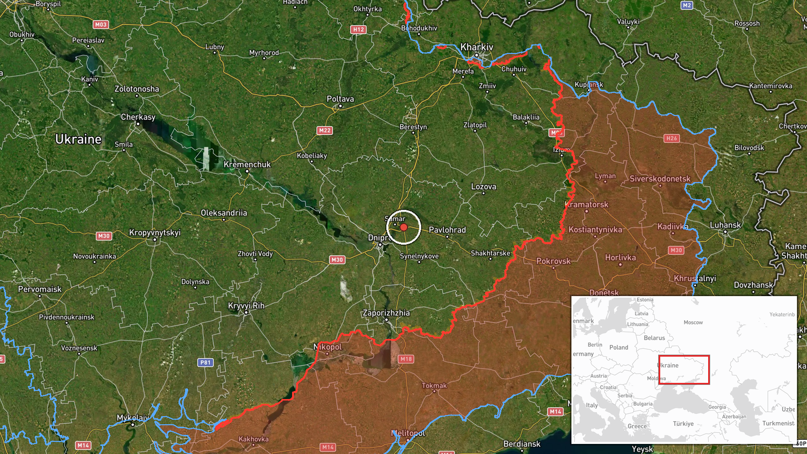
The location is recorded at settlement level, with coordinates 48.61171 N, 35.32952 E, and location confidence rated high in the data, so the pin marks the settlement itself rather than a facility or approximate area. The point sits in central-eastern Ukraine within the Dnipropetrovsk region, in open steppe farmland that is typical of the area. The Dnipro River corridor and its urban centre lie to the west and northwest, and transport links such as roads and rail lines run through the wider area. Because the event is a transit, the pin records where the drone was observed rather than where it was headed.
Related events nearby
- Ukrainian air monitoring: 1 Russian jet-powered Shahed (Geran-3) drone passing Pishchanka, heading northwest.2026-10-23 06:05 UTC · Drone Transit · Pishchanka, Ukraine
- Ukrainian air monitoring: 1 Russian jet-powered Shahed (Geran-3) drone from Dnipropetrovsk Oblast toward Yavor2026-10-23 08:50 UTC · Drone Transit · Yavornytske, Ukraine
- Ukrainian air monitoring: one Russian jet-powered Shahed (Geran-3) drone tracked in the Dnipro area.2026-10-23 09:50 UTC · Drone Transit · Dnipro, Dnipropetrovsk Oblast, Ukraine
- Ukrainian air monitoring: 1 Russian jet-powered Shahed (Geran-3) drone passing Synelnykove, heading toward Dni2026-10-23 09:36 UTC · Drone Transit · Dnipro, Ukraine
- Ukrainian air monitoring: 1 Russian guided glide bomb (KAB) heading toward Dnipropetrovsk Oblast.2026-10-23 08:35 UTC · Airstrike · Dnipropetrovsk Oblast, Ukraine
▶ View this event on the live map

Intel Mapper aggregates open-source reports from monitored Telegram and X channels, geolocates them, cross-checks duplicates across sources and assigns a confidence score. Entries are updated as new confirmations arrive. Read how we verify events.