Two or more Russian Geran-3 jet drones reported heading toward Mykolaiv Oblast, Ukraine
What happened
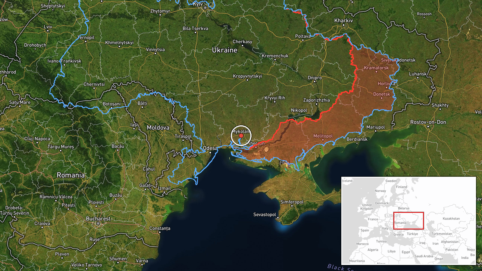
Ukraine's Air Force Telegram channel, @kpszsu, reported at 10:14 UTC on 23 October 2026 that at least two Russian jet-powered Shahed (Geran-3) drones were heading toward Mykolaiv Oblast from the south. The original Ukrainian post described them as jet-powered UAVs arriving from the south, a phrasing that indicates direction of approach rather than a confirmed impact point. The report does not name a settlement, state whether the drones were tracked to a specific target, or mention any damage, casualties or interceptions. The '2+' wording means the exact number was not fixed in the post. Because the report comes from a single channel and no second outlet has been identified for this update, the account remains unverified beyond the monitoring statement itself.
Context and assessment
Mykolaiv Oblast sits on the Black Sea approaches to Odesa and along the Southern Bug estuary, and its port city of Mykolaiv has repeatedly been a target for long-range strikes. The related events show a sustained pattern over roughly fifteen hours. On 22 October at 16:58 UTC a single Geran-3 was logged passing Berezanka heading northwest, and at 17:01 another was reported heading toward Mykolaiv itself. Early on 23 October, single drones were logged passing southern Mykolaiv Oblast heading north at 06:31 and passing the oblast heading northwest at 06:47. The drones appear to move through the area in short, separate transits rather than as one concentrated wave. Shortly afterward, at 08:26, a guided glide bomb was reported heading toward neighbouring Kherson Oblast. Taken together, this suggests a campaign of repeated probing or routing of jet drones across the southern front, possibly to stretch air defence coverage or to reach targets further along the coast. Such an interpretation is tentative, since the reports do not identify intended targets or confirm where the drones ended up.
Sources and confidence
All of the related monitoring entries and this event rest on Ukrainian air monitoring statements, and the event itself is sourced solely to the @kpszsu Telegram channel. There is no independent confirmation from a second outlet, wire service or local authority at the time of writing. The confidence score of 8.0 is high for a single-channel report, reflecting the channel's institutional role and the consistency of the surrounding monitoring entries. It is not higher because the event itself is a transit warning rather than an observed impact, and the count is imprecise. Confidence would rise with corroboration from regional military administrations, debris or impact reports, or wire coverage. It would fall if later updates revised the drone count or direction, or if the warning were withdrawn.
Location
The location is recorded at oblast level, so the coordinates are approximate and do not mark a specific settlement or facility. The point falls at the centre of Mykolaiv city, which is a default placeholder rather than a confirmed position for the drones. Mykolaiv Oblast lies in southern Ukraine, with the Black Sea to the south, Kherson Oblast to the east, and the Southern Bug estuary running through its territory. The flat, low-lying terrain and the river estuaries shape the approach routes for drones heading inland from the coast.
Related events nearby
- Ukrainian air monitoring: 1 Russian jet-powered Shahed (Geran-3) drone passing Mykolaiv Oblast, heading northw2026-10-23 06:47 UTC · Drone Transit · Mykolaiv Oblast, Ukraine
- Ukrainian air monitoring: 1 Russian jet-powered Shahed (Geran-3) drone heading toward Mykolaiv.2026-10-22 17:01 UTC · Drone Transit · Mykolaiv, Ukraine
- Ukrainian air monitoring: 1 Russian jet-powered Shahed (Geran-3) drone passing southern Mykolaiv Oblast, headi2026-10-23 06:31 UTC · Drone Transit · southern Mykolaiv Oblast, Ukraine
- Ukrainian air monitoring: 1 Russian jet-powered Shahed (Geran-3) drone passing Berezanka, heading northwest.2026-10-22 16:58 UTC · Drone Transit · Berezanka, Ukraine
- Ukrainian air monitoring: 1 Russian guided glide bomb (KAB) heading toward Kherson Oblast.2026-10-23 08:26 UTC · Airstrike · Kherson Oblast, Ukraine
▶ View this event on the live map

Intel Mapper aggregates open-source reports from monitored Telegram and X channels, geolocates them, cross-checks duplicates across sources and assigns a confidence score. Entries are updated as new confirmations arrive. Read how we verify events.