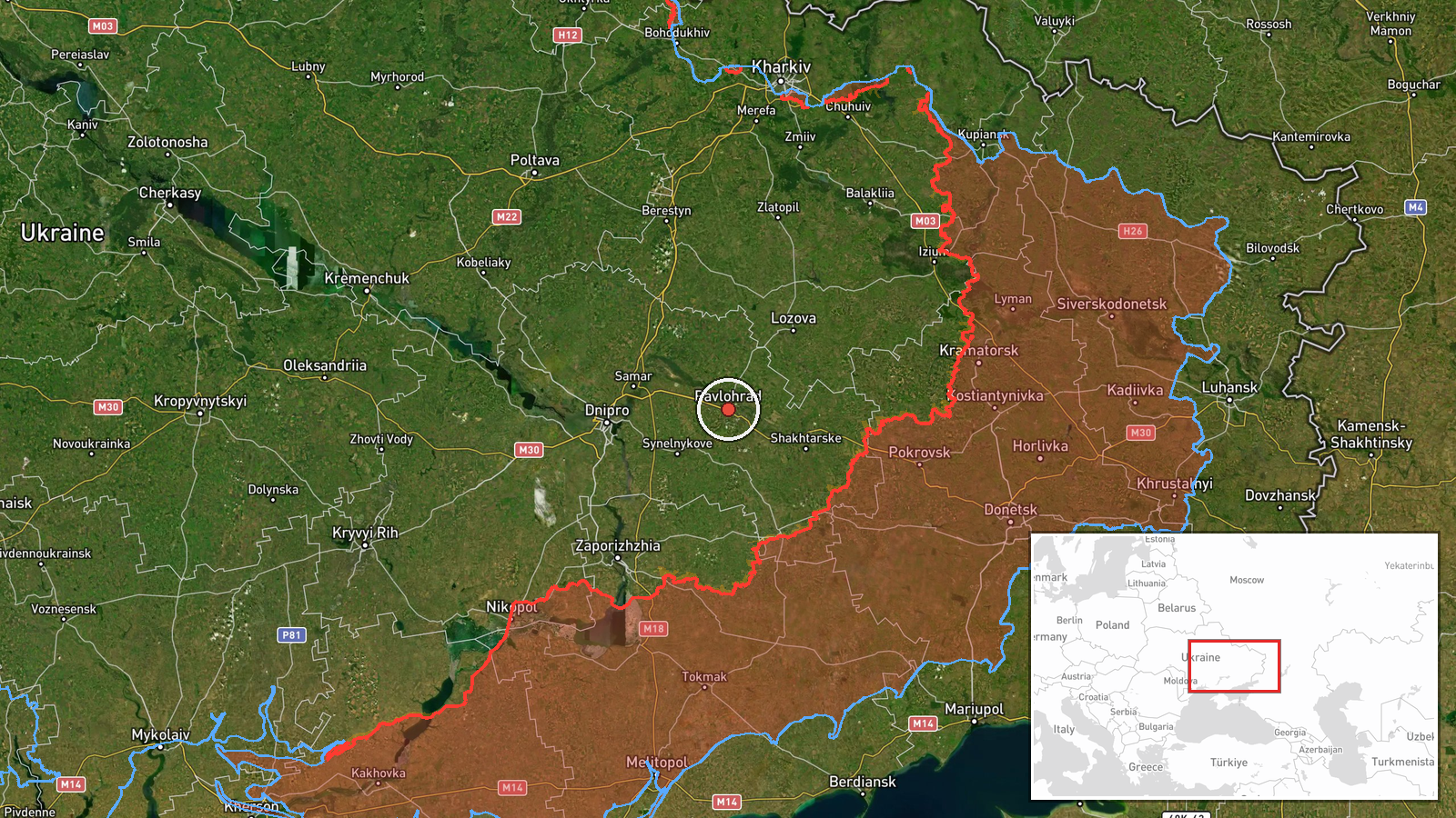
Single jet-powered Shahed (Geran-3) drone reported heading toward Pavlohrad, Ukraine, on 23 October 2026
What happened
Ukrainian air monitoring channel @kpszsu reported at 10:28 UTC on 23 October 2026 that one Russian jet-powered Shahed (Geran-3) drone was heading toward Pavlohrad from the southeast. The original Ukrainian-language post describes it as a jet-type unmanned aerial vehicle approaching Pavlohrad from the south-east. The report is a transit or threat warning rather than a confirmed impact, and it does not state whether the drone was shot down, lost contact or reached the city. Attribution to Russia rests on the channel's framing of the drone type and launch pattern. The event is recorded as a single-source report with no corroborating channel in the data set.
Context and assessment
Pavlohrad, a city in Dnipropetrovsk Oblast in central-eastern Ukraine, is a regional industrial and rail hub, and it lies on routes that Russian long-range drones have repeatedly used when moving northwest from the southeast of the country. The related events show a dense sequence of activity on the same morning. A Shahed-type drone from Dnipropetrovsk Oblast was logged heading toward Pavlohrad at 08:25 UTC, a Banderol mini cruise missile was reported toward the city at 06:20 UTC, and several Geran-3 drones were noted passing the Synelnykove district, Pishchanka and Yavornytske between 07:32 and 09:36 UTC, mostly heading northwest. This clustering suggests a coordinated raid or a stream of drones following similar corridors rather than an isolated flight. Operationally, repeated tracks toward the same settlement may indicate either a deliberate target focus or routing toward wider objectives beyond it, though the data alone does not confirm which.
Sources and confidence
The event rests on one Telegram channel, @kpszsu, which is the official air-monitoring account of the Ukrainian Air Force. Its routine warnings are generally timely, but the data shows no second outlet, official statement or independent tracking confirming this specific drone. The confidence score of 8.0 reflects the channel's institutional standing and the consistency of the surrounding related reports, offset by the absence of cross-confirmation. Confidence would rise if other monitoring sources, regional authorities or open-source flight trackers logged the same track, or if a strike or interception in Pavlohrad was reported. It would fall if later updates revised the drone count or direction, or if the warning were retracted.
Location
The location is recorded as the city of Pavlohrad at settlement-level precision, with coordinates of approximately 48.53 N, 35.87 E. The high location confidence reflects that the source names the city directly rather than a specific facility. Pavlohrad sits on the Vovcha River in the Dnipro basin, on the open steppe of the Dnipropetrovsk region, with rail lines and industrial sites shaping its urban footprint. The surrounding terrain is largely flat and agricultural, which affects drone routing and radar coverage.
Related events nearby
- Ukrainian air monitoring: 1 Russian Shahed-type drone from Dnipropetrovsk Oblast toward Pavlohrad.2026-10-23 08:25 UTC · Drone Transit · Pavlohrad, Ukraine
- Ukrainian air monitoring: 1 Russian Banderol mini cruise missile heading toward Pavlohrad.2026-10-23 06:20 UTC · Cruise Missile · Pavlohrad, Ukraine
- Ukrainian air monitoring: 2+ Russian jet-powered Shahed (Geran-3) drones passing Synelnykove district, heading2026-10-23 07:32 UTC · Drone Transit · Synelnykove district, Ukraine
- Ukrainian air monitoring: 1 Russian jet-powered Shahed (Geran-3) drone passing Pishchanka, heading northwest.2026-10-23 09:36 UTC · Drone Transit · Pishchanka, Ukraine
- Ukrainian air monitoring: 1 Russian jet-powered Shahed (Geran-3) drone from Dnipropetrovsk Oblast toward Yavor2026-10-23 08:50 UTC · Drone Transit · Yavornytske, Ukraine
▶ View this event on the live map

Intel Mapper aggregates open-source reports from monitored Telegram and X channels, geolocates them, cross-checks duplicates across sources and assigns a confidence score. Entries are updated as new confirmations arrive. Read how we verify events.