Two or more jet-powered Shahed drones reported transiting Vinnytsia Oblast, heading northwest
What happened
A Ukrainian military-linked Telegram channel, @kpszsu, reported on 23 October 2026 at about 12:02 UTC that two or more Russian jet-powered Shahed (Geran-3) drones were passing near the settlements of Sharhorod and Dzhurin in Vinnytsia Oblast, moving in a northwestern direction. The original post uses the Ukrainian phrase for jet-type unmanned aerial vehicles and names the two localities as reference points rather than as targets. The report describes transit only; it does not mention impacts, casualties, damage, or air-raid outcomes. The count is stated as 'two or more', so the true number may be higher. This was the fifth transit report for the oblast that day and the day before.
Context and assessment
Vinnytsia Oblast lies in west-central Ukraine, a corridor that Russian long-range drones have repeatedly crossed on routes from the south and east toward western regions. Earlier reports the same morning described single drones entering from Odesa Oblast and passing the Podilsk district toward Vinnytsia, followed by a formation of at least two aircraft heading northwest at 11:49 UTC. The pattern suggests drones launched from the Black Sea and southern axes being routed across central and western Ukraine, with the northwestward heading consistent with trajectories toward Volyn, Rivne or Lviv oblasts or toward Belarusian airspace. Transit reports of this kind are typically issued so that air defence units, regional authorities and civilians can respond, and they are not in themselves evidence of a specific intended target. The rising count across the morning may indicate a larger wave, but the single-channel data cannot confirm its scale or purpose.
Sources and confidence
The event rests on one Telegram channel, @kpszsu, which is associated with the Ukrainian Air Force's public reporting. No independent outlet, official regional statement or wire service in the dataset confirms the transit. Confidence is scored at 8.0 because the channel is institutional and the sequence of linked reports is internally consistent, but single-source status and the absence of corroboration keep it below the top of the scale. Confidence would rise with confirmation from the Air Force's official feed, regional military administration statements, or observed debris or impact reports. It would fall if later updates retract the heading or count, or if the drones are attributed to a different flight path.
Location
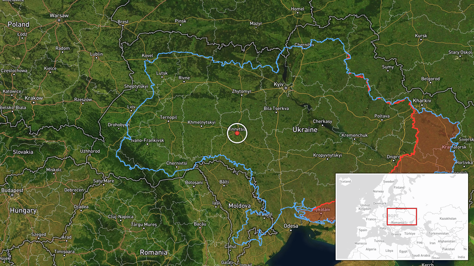
The coordinates place the event at the regional level of Vinnytsia Oblast, not at a precise point, because the source names villages and districts without grid references. The location confidence is therefore low, and the marker should be read as the oblast centre rather than the route of the drones. Vinnytsia Oblast is a largely agricultural region of rolling terrain, drained by the Southern Bug River, with the city of Vinnytsia on the river as its administrative centre. Sharhorod lies to the south-west of the oblast centre and Dzhurin lies in the same broad area, both within the central-southern part of the region.
Related events nearby
- Ukrainian air monitoring: 2+ Russian jet-powered Shahed (Geran-3) drones passing Vinnytsia Oblast, heading nor2026-10-23 11:49 UTC · Drone Transit · Vinnytsia Oblast, Ukraine
- Ukrainian air monitoring: 1 Russian jet-powered Shahed (Geran-3) drone passing Podilsk district, heading towar2026-10-23 09:15 UTC · Drone Transit · Vinnytsia Oblast, Ukraine
- Ukrainian air monitoring: 1 Russian jet-powered Shahed (Geran-3) drone from Odesa Oblast toward Vinnytsia Obla2026-10-23 08:13 UTC · Drone Transit · Vinnytsia Oblast, Ukraine
- Ukrainian air monitoring: 1 Russian jet-powered Shahed (Geran-3) drone passing Vinnytsia Oblast, heading north2026-10-23 07:23 UTC · Drone Transit · Vinnytsia Oblast, Ukraine
- Ukrainian air monitoring: 1 Russian jet-powered Shahed (Geran-3) drone heading toward Vinnytsia.2026-10-22 17:41 UTC · Drone Transit · Vinnytsia, Ukraine
▶ View this event on the live map

Intel Mapper aggregates open-source reports from monitored Telegram and X channels, geolocates them, cross-checks duplicates across sources and assigns a confidence score. Entries are updated as new confirmations arrive. Read how we verify events.