Geran-3 jet drone reported transiting Vinnytsia Oblast heading northwest
What happened
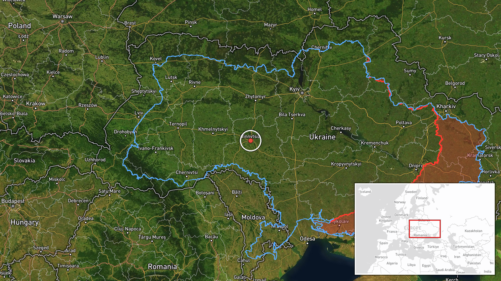
Ukrainian air monitoring channel @kpszsu reported at 07:23 UTC on 23 October 2026 that one Russian jet-powered Shahed, designated Geran-3, was passing near Dzygivka in Vinnytsia Oblast and moving northwest. The original Ukrainian-language post describes a reactive drone passing the village and gives no altitude, speed, or payload details. The report is a single-channel alert that describes transit only, with no strike, casualty, or damage claim. It belongs to a sequence of Geran-3 transit reports across Vinnytsia Oblast on 22 October 2026, starting at 09:09 UTC near Ananyiv and continuing through the evening, with the last entry at 17:41 UTC. The coordinates attached to this event are region-level rather than a confirmed village position.
Context and assessment
Vinnytsia Oblast lies in west-central Ukraine, well behind the front lines in the east and south. It contains the Southern Bug river corridor, a dense rail and road network, and the Zhmerynka junction, an important rail hub on routes linking central Ukraine with the west and south. Five related Geran-3 entries on 22 October show the drone moving through the oblast over several hours: it was reported near Ananyiv, then toward Zhmerynka, then repeatedly toward and over Vinnytsia. The 'heading toward' wording recurring across these entries suggests that air monitoring was following one track rather than recording separate launches. Operationally, a single drone tracked across a region this far from the front may indicate a long-range route through central Ukraine, a probe of air defence coverage, or a path toward targets further west or north. The northwest heading in the latest report could point toward Zhytomyr, Rivne or Volyn, but the single-channel data cannot confirm any target. Nothing in the record indicates intended destination or impact.
Sources and confidence
The event rests on one Telegram channel, @kpszsu, which relays Ukrainian air monitoring alerts. No second outlet, official statement, or local administration report is included in the data, so cross-confirmation is absent. The confidence score of 8.0 reflects the consistency of the related Geran-3 reports from the same channel on the same day and the specificity of the drone type and direction, while the single source and region-level location keep it below the top range. Confidence would rise with an independent confirmation from the Air Force, a regional military administration, or an open monitoring feed matching the track. It would fall if the channel issued a correction or if later reports contradicted the direction or type.
Location
The coordinates (49.23, 28.47) are region-level and sit near the city of Vinnytsia rather than the village of Dzygivka, which the data does not place precisely. The location is therefore approximate and should be read as somewhere within Vinnytsia Oblast. The oblast is largely agricultural and wooded, sits on the Podillia upland, and is crossed by the Southern Bug and its tributaries. Its main settlements are linked by rail and highway, which lends the area strategic transit value.
Related events nearby
- Ukrainian air monitoring: 1 Russian jet-powered Shahed (Geran-3) drone heading toward Vinnytsia.2026-10-22 17:41 UTC · Drone Transit · Vinnytsia, Ukraine
- Ukrainian air monitoring: 1 Russian jet-powered Shahed (Geran-3) drone over Vinnytsia.2026-10-22 17:32 UTC · Drone Transit · Vinnytsia, Ukraine
- Ukrainian air monitoring: 1 Russian jet-powered Shahed (Geran-3) drone heading toward Vinnytsia.2026-10-22 17:28 UTC · Drone Transit · Vinnytsia, Ukraine
- Ukrainian air monitoring: 1 Russian jet-powered Shahed (Geran-3) drone passing Ananyiv, heading toward Vinnyts2026-10-22 09:09 UTC · Drone Transit · Vinnytsia Oblast, Ukraine
- Ukrainian air monitoring: 1 Russian jet-powered Shahed (Geran-3) drone heading toward Zhmerynka.2026-10-22 17:02 UTC · Drone Transit · Zhmerynka, Ukraine
▶ View this event on the live map

Intel Mapper aggregates open-source reports from monitored Telegram and X channels, geolocates them, cross-checks duplicates across sources and assigns a confidence score. Entries are updated as new confirmations arrive. Read how we verify events.