Jet-powered Shahed drone reported in Odesa Oblast, moving toward Vinnytsia Oblast
What happened
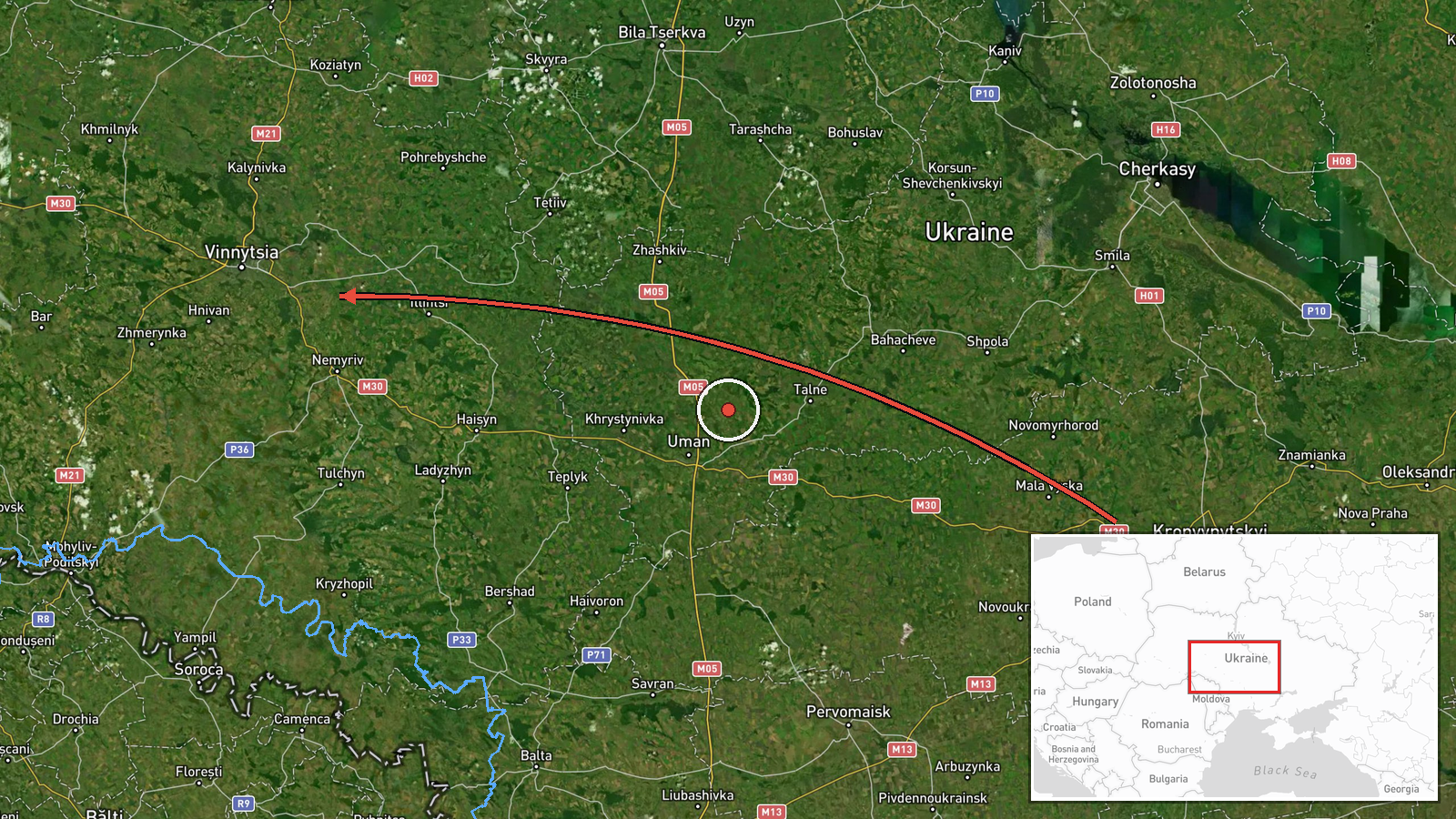
Ukraine's air monitoring channel on Telegram, @kpszsu, reported at 09:15 UTC on 23 October 2026 that one Russian jet-powered Shahed, designated Geran-3, was passing through Podilsk district and heading toward Vinnytsia Oblast. The original Ukrainian wording places the drone in Podilsk district of Odesa Oblast, while the English summary simply says it was passing Podilsk district. The report describes a transit, not a strike. No impact, casualties or damage are mentioned. The item is part of a series: five earlier posts from 22 to 23 October track the same type of drone over or toward Vinnytsia, the most recent at 08:13 UTC describing it as moving from Odesa Oblast toward Vinnytsia Oblast.
Context and assessment
Vinnytsia is a major regional centre in west-central Ukraine, and its oblast lies on routes that Russian long-range drones have used to cross from the south toward western Ukraine. The related events show a pattern over roughly fifteen hours. The drone was reported over Vinnytsia city at 17:32 UTC on 22 October, then heading toward the city, then passing the oblast heading northwest, and then reported coming from Odesa Oblast toward Vinnytsia. Repeated reports of a single airframe over one area could mean one drone wandering through a corridor, several drones using similar tracks, or monitors re-reporting as the track changes. The shift from northwest-bound to inbound suggests either a changed course or a different drone. Operationally, transit reports like these are usually read as signs of tracking and of possible targets along the route rather than confirmed attack intent. The jet-powered variant is generally understood to be faster than the piston-engined Shahed, which would shorten warning time for residents. None of the related items reports an impact.
Sources and confidence
Only one channel reported this event: the Telegram account @kpszsu, which is widely understood to be the Ukrainian Air Force's monitoring channel. Cross-confirmation is absent. The confidence score of 8.0 reflects a routine, official-linked, timestamped channel and a consistent series of related posts. It stays short of the top of the scale because no independent source corroborates the track and the location wording differs between the summary and the original text. Confidence would rise with a second monitoring source, a matching flight track, or an official statement. It would fall if later posts contradicted the direction of travel.
Location
The location is recorded at region level only: Vinnytsia Oblast, with a coordinate of 49.23 N, 28.47 E, and low precision. The point marks the oblast in general, not a settlement or facility. The original text places the drone in Podilsk district of Odesa Oblast, which lies south of Vinnytsia Oblast, so the actual track was probably outside the plotted point. The Southern Bug river runs through the region, and the surrounding terrain is mostly rolling agricultural plain.
Related events nearby
- Ukrainian air monitoring: 1 Russian jet-powered Shahed (Geran-3) drone from Odesa Oblast toward Vinnytsia Obla2026-10-23 08:13 UTC · Drone Transit · Vinnytsia Oblast, Ukraine
- Ukrainian air monitoring: 1 Russian jet-powered Shahed (Geran-3) drone passing Vinnytsia Oblast, heading north2026-10-23 07:23 UTC · Drone Transit · Vinnytsia Oblast, Ukraine
- Ukrainian air monitoring: 1 Russian jet-powered Shahed (Geran-3) drone heading toward Vinnytsia.2026-10-22 17:41 UTC · Drone Transit · Vinnytsia, Ukraine
- Ukrainian air monitoring: 1 Russian jet-powered Shahed (Geran-3) drone over Vinnytsia.2026-10-22 17:32 UTC · Drone Transit · Vinnytsia, Ukraine
- Ukrainian air monitoring: 1 Russian jet-powered Shahed (Geran-3) drone heading toward Vinnytsia.2026-10-22 17:28 UTC · Drone Transit · Vinnytsia, Ukraine
▶ View this event on the live map

Intel Mapper aggregates open-source reports from monitored Telegram and X channels, geolocates them, cross-checks duplicates across sources and assigns a confidence score. Entries are updated as new confirmations arrive. Read how we verify events.