Jet-powered Shahed-type drones reported over Nikopol district, heading north
What happened
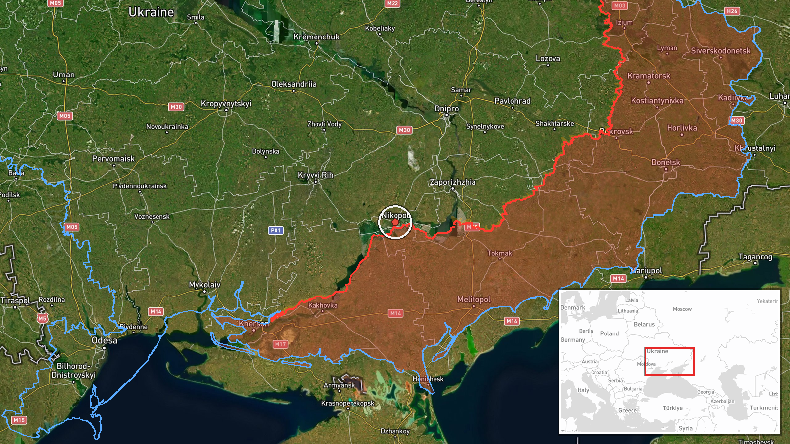
Ukraine's Air Force, through its Telegram channel @kpszsu, reported at 12:14 UTC on 23 October 2026 that jet-powered unmanned aerial vehicles were passing through Nikopol district of Dnipropetrovsk Oblast and moving in a northerly direction. The original Ukrainian-language post refers to reactive UAVs and uses an arrow to indicate heading. It does not state how many aircraft were involved, their altitude, or whether any were intercepted. The summary's identification of the drones as Russian Geran-3 jet-powered Shahed variants is the classification used in the event record, not an explicit attribution in the post. No impacts, casualties, or damage were reported for this location in the available material.
Context and assessment
Nikopol sits on the right bank of the Dnipro, facing the Russian-held left bank across the river, and it has been under repeated fire for much of the war. Earlier reports the same day show a sequence over the southern front. Shahed-type drones were reported over Zaporizhzhia at 16:59 and 17:01 UTC on 22 October. A jet-powered group was reported over Zaporizhzhia at 02:16 on 23 October. A guided glide bomb was reported heading toward Zaporizhzhya Oblast at 08:06, and a warning about tactical aviation and guided aerial weapons threatening frontline oblasts followed at 08:14. Taken together, the pattern suggests drones tracking along the lower Dnipro and then turning north. This could indicate a route toward industrial or logistics targets further inland, or decoy and saturation tactics meant to stretch air defence across several oblasts. Because the report describes transit rather than impact, the intended target is unknown, and Nikopol itself may not have been the destination. A single northward heading should not be read as a confirmed objective. The jet-powered variant is faster than older propeller-driven Shaheds, which shortens warning times for mobile fire groups.
Sources and confidence
The event rests on one Telegram channel, @kpszsu, which is the official Ukrainian Air Force feed for air-threat alerts. No other outlet, air-defence statement, or regional military administration appears in the record to corroborate it. The score of 8.0 reflects a credible official origin offset by single-channel reliance and the lack of independent confirmation. Confidence would rise with a second official or regional report naming the same heading or with reports of interception or wreckage in Dnipropetrovsk. It would fall if later updates retracted the alert or if the drone classification proved unsupported.
Location
The coordinates are settlement-level and placed within Nikopol district in Dnipropetrovsk Oblast, with high location confidence. The point marks the district rather than a specific street or facility, and the drones' exact track is not known. Nikopol lies on the Dnipro's right bank, with the Zaporizhzhia nuclear plant and the former Kakhovka reservoir corridor to the south and east. The river and its floodplain are the main terrain features in the area.
Related events nearby
- Ukrainian military warns of enemy tactical aviation activity in the southern direction and a threat of guided 2026-10-23 08:14 UTC · Siren · Zaporizhzhia, Ukraine
- Ukrainian air monitoring: 2+ Russian jet-powered Shahed (Geran-3) drones over Zaporizhzhia.2026-10-23 02:16 UTC · Drone Transit · Zaporizhzhia, Ukraine
- Ukrainian air monitoring: 1 Russian Shahed-type drone heading toward Zaporizhzhia.2026-10-22 17:01 UTC · Drone Transit · Zaporizhzhia, Ukraine
- Ukrainian air monitoring: 1 Russian Shahed-type drone over Zaporizhzhia.2026-10-22 16:59 UTC · Drone Transit · Zaporizhzhia, Ukraine
- Ukrainian air monitoring: 1 Russian guided glide bomb (KAB) heading toward Zaporizhzhya Oblast.2026-10-23 08:06 UTC · Airstrike · Zaporizhzhya Oblast, Ukraine
▶ View this event on the live map

Intel Mapper aggregates open-source reports from monitored Telegram and X channels, geolocates them, cross-checks duplicates across sources and assigns a confidence score. Entries are updated as new confirmations arrive. Read how we verify events.