Lebanese forces report territorial gains in Nabatîyé amid multi-sided combat
What happened
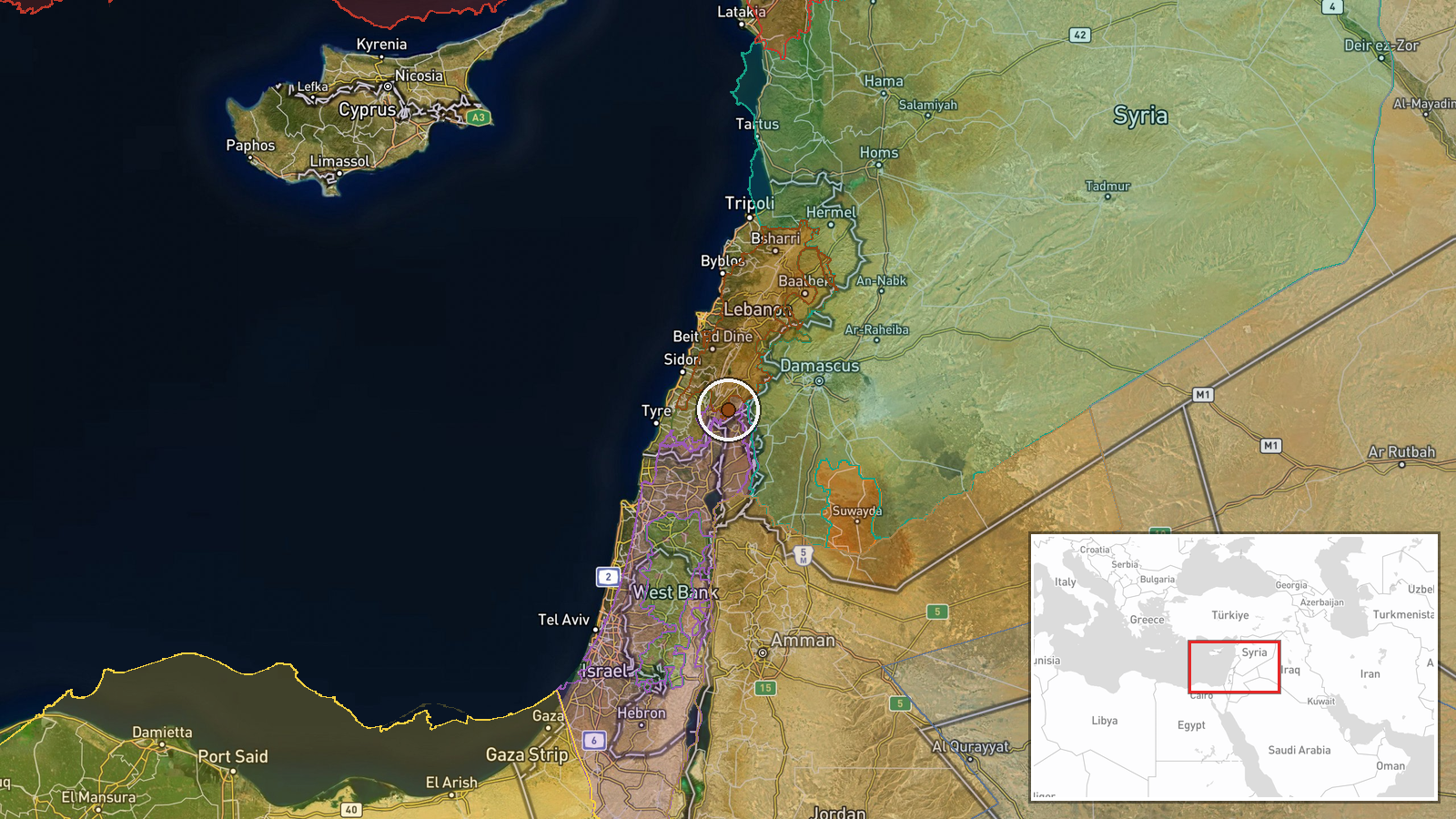
According to updated conflict control mapping, Lebanese state forces expanded territorial control by approximately 15 square kilometres in the Nabatîyé region of southern Lebanon on 10 September. The report originates from Wiki conflict control map tracking. This claim coincides with reported gains by Israeli, Hezbollah, and other Lebanese forces in the same area on the same date, suggesting active multi-sided combat operations across the district.
Context and assessment
Nabatîyé in south Lebanon remains a contested zone where state Lebanese authority, Hezbollah-affiliated forces, and Israeli military operations intersect. The simultaneous reporting of territorial changes by multiple actors—Lebanese state forces, Israel, and Hezbollah—within hours on 10 September indicates intense localised combat activity. Related Israeli airstrikes on Ali Taher Ridge and Beaufort Ridge the same day targeting Iranian-aligned positions suggest a coordinated operational tempo. Such fluid control maps in active conflict zones often reflect real-time tactical shifts, though their precision varies considerably.
Sources and confidence
Single source: Wiki conflict control map. No independent cross-confirmation reported. Confidence score of 7.5 reflects the inherent uncertainty of map-based territorial claims during active hostilities, particularly when sourced to a single mapping platform rather than direct military or field reports. Confirmation from independent observers, satellite imagery analysis, or military statements would strengthen confidence. Contradictory claims from other actors in the same zone lower reliability.
Location
Nabatîyé district, southern Lebanon, situated inland from the Mediterranean coast approximately 40 kilometres south-southwest of Beirut. The region lies within the traditional Hezbollah-influenced areas of south Lebanon and has been subject to Israeli military operations. Geographic precision is regional rather than specific facility-level.
Related events nearby
- Israel forces expanded control (~10 km²) in the Nabatîyé area per updated conflict control map.2026-09-10 17:30 UTC · Combat · Nabatîyé
- Israel forces expanded control (~34 km²) in the Nabatîyé area per updated conflict control map.2026-09-10 17:30 UTC · Combat · Nabatîyé
- Hezbollah forces expanded control (~11 km²) in the Nabatîyé area per updated conflict control map.2026-09-10 17:30 UTC · Combat · Nabatîyé
- Hezbollah forces expanded control (~106 km²) in the Nabatîyé area per updated conflict control map.2026-09-10 17:30 UTC · Combat · Nabatîyé
- Israeli Merkava main battle tank spotted positioned on Baraachit Ridge in southern Lebanon as part of ongoing 2026-09-10 18:50 UTC · Deployment · Baraachit Ridge, South Lebanon, Lebanon
▶ View this event on the live map
Intel Mapper aggregates open-source reports from monitored Telegram and X channels, geolocates them, cross-checks duplicates across sources and assigns a confidence score. Entries are updated as new confirmations arrive. Read how we verify events.