Hezbollah expands territorial control in Nabatîyé region, southern Lebanon
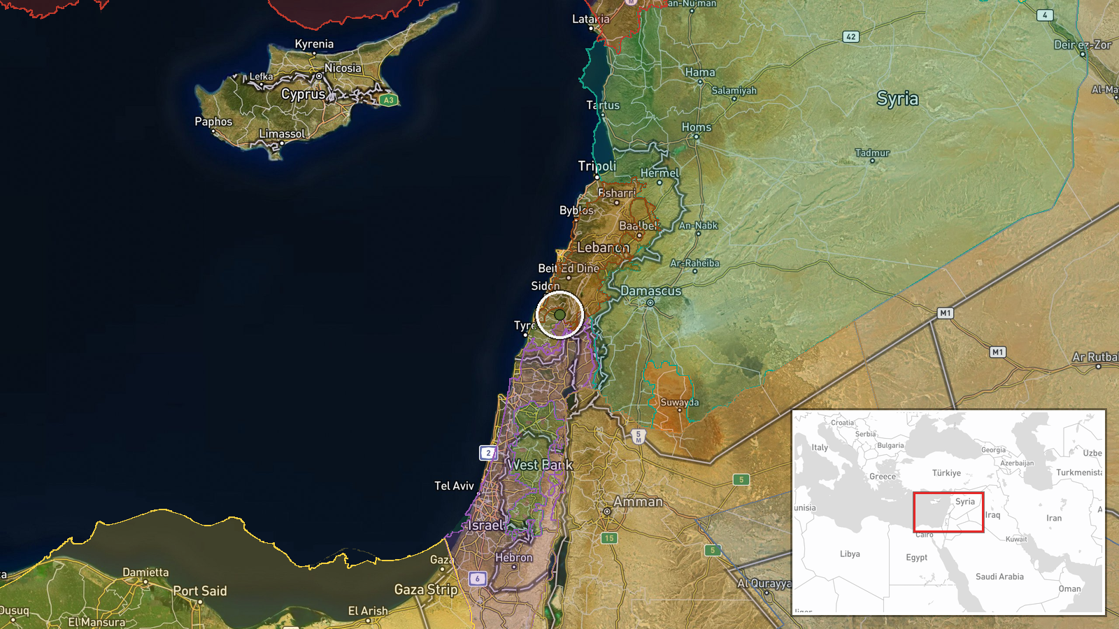
What happened
According to updates to a conflict control map, Hezbollah forces expanded their territorial control by approximately 106 square kilometers in the Nabatîyé region of southern Lebanon on September 10. The same mapping source recorded simultaneous territorial shifts by Lebanese state forces (approximately 15 km²) and Israeli forces (approximately 44 km² across multiple entries) in the same area, indicating intense multi-sided competition for control of the region during the reporting period.
Context and assessment
Nabatîyé, a municipality in Lebanon's southern governorate bordering Israel, has been a contested area throughout the conflict between Israel and Hezbollah. The reported expansion reflects ongoing ground operations in southern Lebanon where multiple actors—Israeli military, Lebanese armed forces, and Hezbollah—are vying for territorial control. The simultaneity of reported gains by all parties on the same date suggests either rapid tactical shifts or competing claims to the same terrain. These territorial changes occur alongside documented Israeli airstrikes in the Ali Taher Ridge area targeting what Israeli officials characterize as Iranian-aligned positions, indicating a broader campaign combining air and ground operations in the region.
Sources and confidence
A single source—described as a wiki-based conflict control map—reported the expansion. The map simultaneously recorded territorial claims by three other actors in the identical location and timeframe. No independent confirmation from military statements, news agencies, or alternative mapping sources is noted. The moderate confidence score of 7.5 reflects single-source reporting and the inherent uncertainty of real-time territorial mapping, which may show competing claims rather than verified ground control.
Location
Nabatîyé is a municipality in southern Lebanon's Nabatîyé Governorate, located approximately 40 kilometers south of Beirut and near the Israeli border. The coordinates place the report in the coastal and pre-mountainous zone of southern Lebanon. The region's proximity to Israel and historical Hezbollah presence make it strategically significant in cross-border operations and Israeli security concerns.
Related events nearby
- Lebanon forces expanded control (~15 km²) in the Nabatîyé area per updated conflict control map.2026-09-10 17:30 UTC · Combat · Nabatîyé
- Israel forces expanded control (~10 km²) in the Nabatîyé area per updated conflict control map.2026-09-10 17:30 UTC · Combat · Nabatîyé
- Israel forces expanded control (~34 km²) in the Nabatîyé area per updated conflict control map.2026-09-10 17:30 UTC · Combat · Nabatîyé
- Hezbollah forces expanded control (~11 km²) in the Nabatîyé area per updated conflict control map.2026-09-10 17:30 UTC · Combat · Nabatîyé
- Israel conducted airstrikes destroying infrastructure on Beaufort Ridge in southern Lebanon as part of operati2026-09-10 17:47 UTC · Airstrike · Ali Taher Ridge, South Lebanon
▶ View this event on the live map
Intel Mapper aggregates open-source reports from monitored Telegram and X channels, geolocates them, cross-checks duplicates across sources and assigns a confidence score. Entries are updated as new confirmations arrive. Read how we verify events.