Israel expands control in Nabatîyé region amid intense South Lebanon operations
What happened
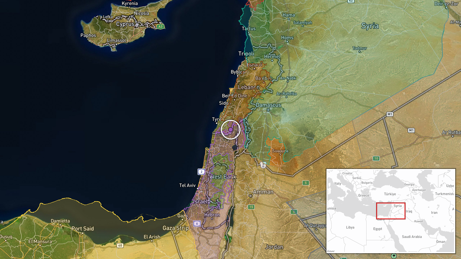
According to a conflict control map update, Israeli forces expanded territorial control by approximately 10 square kilometres in the Nabatîyé area on 10 September 2026. The update was logged at 17:30 UTC. The report provides no details on the means of expansion, whether through ground manoeuvre, air support, or other military action. Nabatîyé is a municipality in South Lebanon bordering Israel.
Context and assessment
Nabatîyé sits in the contested border zone of South Lebanon where Israeli and Lebanese/Hezbollah forces have conducted sustained operations. The same timestamp produced multiple control map updates in this region: Lebanese forces reportedly gained approximately 15 square kilometres while Hezbollah forces made larger gains of roughly 11 and 106 square kilometres. These simultaneous competing claims suggest fluid and contested control rather than stable territorial lines. A nearby airstrike on Ali Taher Ridge the same evening indicates continued Israeli air operations targeting infrastructure in the wider theatre. The pattern suggests ongoing low-intensity conflict with shifting frontlines characteristic of the 2026 Israel–Hezbollah escalation.
Sources and confidence
Single source: Wiki control map updated 10 September 2026 at 17:30 UTC. No independent corroboration reported. Confidence score of 7.5/10 reflects reliance on a single mapping source; control map data often lags ground reality and may reflect claimed rather than verified territorial possession. Confirmation by independent military observers, satellite imagery analysis, or statement from Israeli military would substantially raise confidence. Contradictory claims by other actors at the same timestamp lower certainty of actual Israeli control.
Location
Nabatîyé is a southern Lebanese municipality approximately 5 kilometres from the Israeli border. Precision is regional rather than pinpointed due to the scale of reported expansion. The area lies within the traditional Hezbollah stronghold of South Lebanon, south of the Litani River, and comprises mixed terrain of villages, agricultural land, and hills.
Related events nearby
- Lebanon forces expanded control (~15 km²) in the Nabatîyé area per updated conflict control map.2026-09-10 17:30 UTC · Combat · Nabatîyé
- Israel forces expanded control (~34 km²) in the Nabatîyé area per updated conflict control map.2026-09-10 17:30 UTC · Combat · Nabatîyé
- Hezbollah forces expanded control (~11 km²) in the Nabatîyé area per updated conflict control map.2026-09-10 17:30 UTC · Combat · Nabatîyé
- Hezbollah forces expanded control (~106 km²) in the Nabatîyé area per updated conflict control map.2026-09-10 17:30 UTC · Combat · Nabatîyé
- Israel conducted airstrikes destroying infrastructure on Beaufort Ridge in southern Lebanon as part of operati2026-09-10 17:47 UTC · Airstrike · Ali Taher Ridge, South Lebanon
▶ View this event on the live map
Intel Mapper aggregates open-source reports from monitored Telegram and X channels, geolocates them, cross-checks duplicates across sources and assigns a confidence score. Entries are updated as new confirmations arrive. Read how we verify events.