Israel strikes Beaufort Ridge infrastructure in southern Lebanon operation
What happened
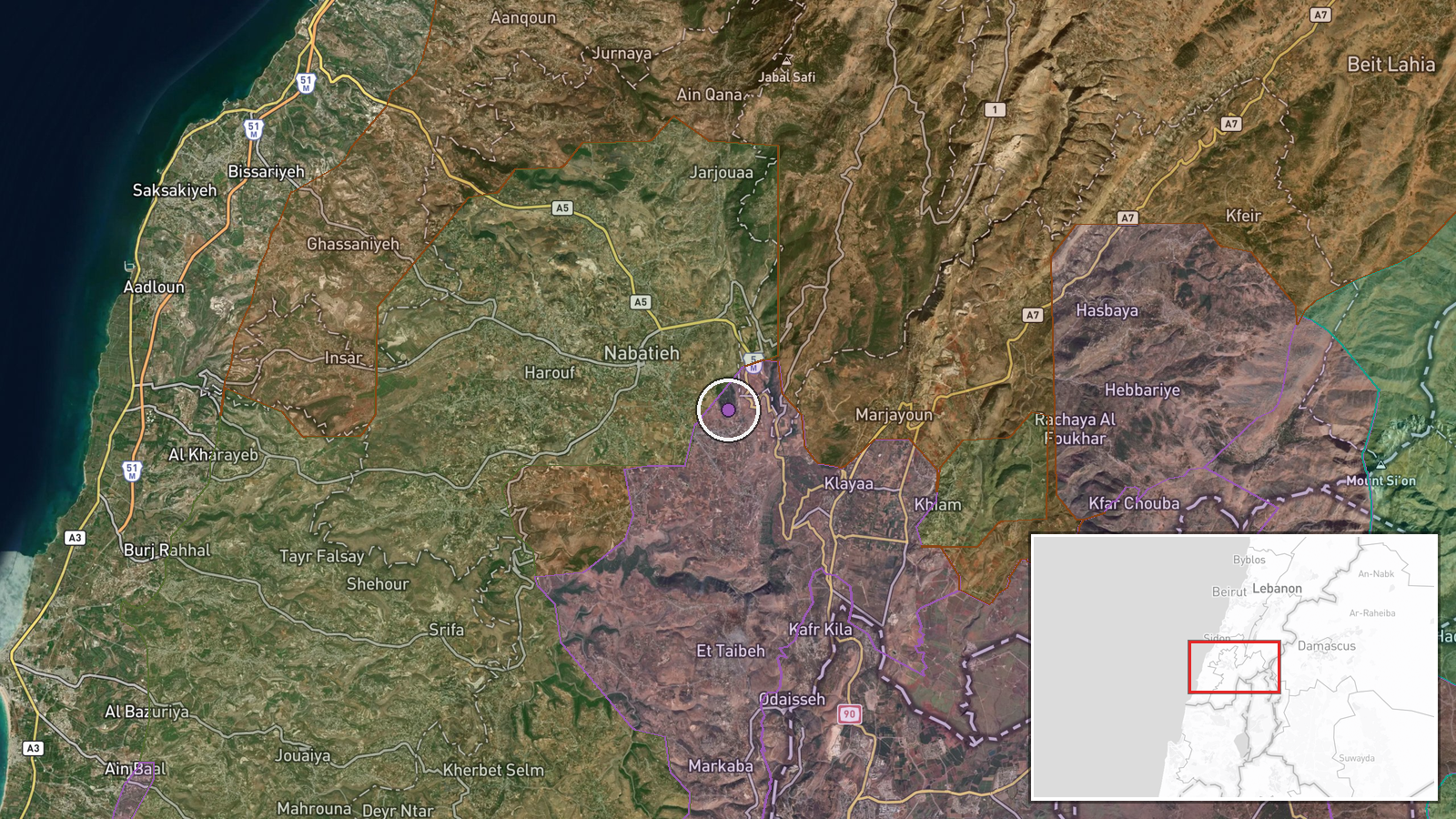
Israel conducted airstrikes on 10 September targeting infrastructure on Beaufort Ridge (Ali Taher Ridge) in southern Lebanon, according to Telegram channel ClashReport. The strikes were described as part of broader operations against Iranian-aligned positions and Hezbollah assets in the region. No details were provided regarding specific facilities struck, damage assessment, or casualties.
Context and assessment
Beaufort Ridge sits in a strategically sensitive zone of southern Lebanon where control remains contested. The strike occurred as multiple armed factions—Israeli forces, Hezbollah, and Lebanese military units—simultaneously expanded territorial control in the nearby Nabatîyé area on the same date, suggesting active ground-level competition for influence. The ridge's elevated position makes it operationally significant for surveillance and positioning. Israeli operations targeting Iranian-aligned infrastructure in Lebanon have intensified as part of the broader regional conflict between Israel and Tehran-backed groups, with such strikes typically aimed at disrupting supply lines or command-and-control capabilities.
Sources and confidence
Reported solely by Telegram channel ClashReport on 10 September. Single-source reporting results in the moderate confidence score of 7.0. Cross-confirmation from independent sources or official statements would strengthen reliability. Visual documentation of damage or statements from Lebanese or Israeli officials would raise confidence; absence of corroboration from regional media or additional channels may indicate preliminary reporting.
Location
Ali Taher Ridge (also referred to as Beaufort Ridge) in southern Lebanon, positioned at coordinates 33.3611°N, 35.5194°E with exact precision. The ridge lies in the Nabatîyé Governorate near the Israeli-Lebanese border region, part of elevated terrain that dominates the southern Lebanese landscape and overlooks surrounding valleys and settlements.
Related events nearby
- Hezbollah forces expanded control (~106 km²) in the Nabatîyé area per updated conflict control map.2026-09-10 17:30 UTC · Combat · Nabatîyé
- Israel forces expanded control (~34 km²) in the Nabatîyé area per updated conflict control map.2026-09-10 17:30 UTC · Combat · Nabatîyé
- Hezbollah forces expanded control (~11 km²) in the Nabatîyé area per updated conflict control map.2026-09-10 17:30 UTC · Combat · Nabatîyé
- Lebanon forces expanded control (~15 km²) in the Nabatîyé area per updated conflict control map.2026-09-10 17:30 UTC · Combat · Nabatîyé
- Israel forces expanded control (~10 km²) in the Nabatîyé area per updated conflict control map.2026-09-10 17:30 UTC · Combat · Nabatîyé
▶ View this event on the live map
Intel Mapper aggregates open-source reports from monitored Telegram and X channels, geolocates them, cross-checks duplicates across sources and assigns a confidence score. Entries are updated as new confirmations arrive. Read how we verify events.