Israel expands control in Nabatîyé region as multi-faction combat continues
What happened
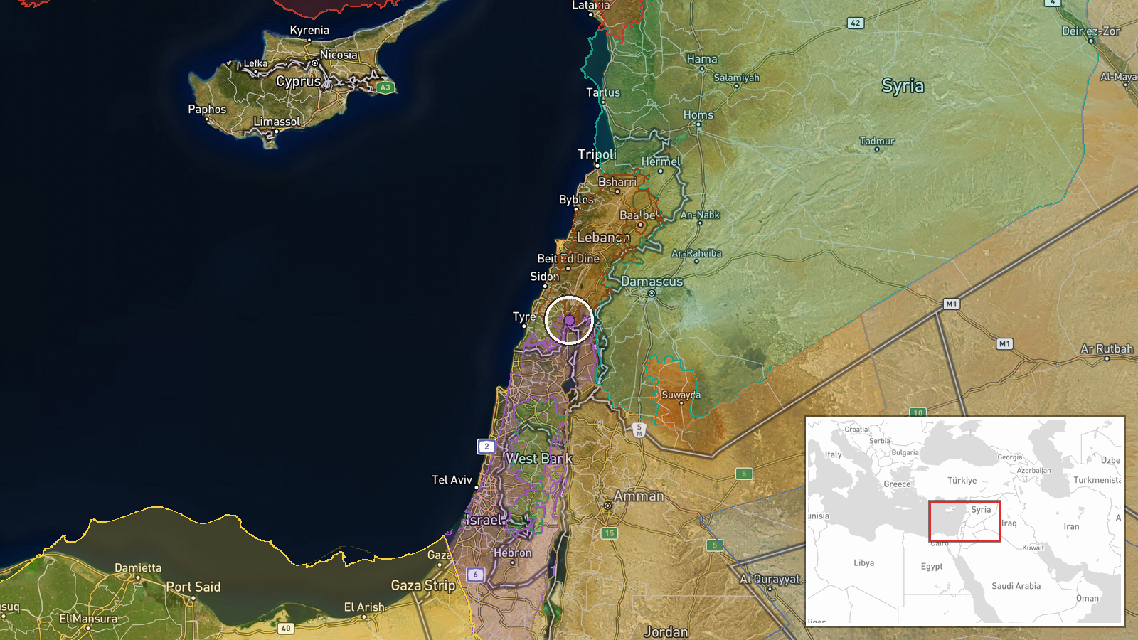
Israeli forces expanded territorial control by approximately 34 square kilometres in the Nabatîyé region of southern Lebanon on 10 September, according to updates to a conflict control map. The expansion occurred amid simultaneous territorial shifts by Lebanese forces, Hezbollah, and Israeli operations in the same area. The timing coincides with Israeli airstrikes reported on nearby Ali Taher Ridge targeting infrastructure identified as Iranian-aligned positions.
Context and assessment
Nabatîyé is a densely populated region in southern Lebanon approximately 10 kilometres from the Israeli border, historically significant as a Shia population centre and area of Hezbollah presence. The reported 34 km² expansion reflects intensified ground operations in a zone where Israeli, Lebanese state, and Hezbollah forces are competing for control. Related map updates show Hezbollah also expanded control by over 106 km² in the same region on the same date, suggesting fluid front lines and rapid territorial fluctuations typical of active combat zones. Concurrent airstrikes on nearby ridges indicate a broader campaign combining ground and air operations.
Sources and confidence
Report sourced from Wiki control map, a crowdsourced mapping platform tracking real-time territorial changes. Single source for this specific figure limits independent verification. Confidence score of 7.5 reflects the map's general reliability but acknowledges source singularity. Cross-confirmation from satellite imagery or military statements would substantially raise confidence; discrepancies with other mapping services would lower it.
Location
Nabatîyé region, southern Lebanon, approximately 33.32°N 35.59°E. The region encompasses multiple settlements and extends inland from the Mediterranean coastal plain toward higher terrain. Situated roughly 10 km north of the Israeli border and south of Sidon, it represents a transitional zone between coastal lowlands and interior hills of the Lebanes hinterland.
Related events nearby
- Lebanon forces expanded control (~15 km²) in the Nabatîyé area per updated conflict control map.2026-09-10 17:30 UTC · Combat · Nabatîyé
- Israel forces expanded control (~10 km²) in the Nabatîyé area per updated conflict control map.2026-09-10 17:30 UTC · Combat · Nabatîyé
- Hezbollah forces expanded control (~11 km²) in the Nabatîyé area per updated conflict control map.2026-09-10 17:30 UTC · Combat · Nabatîyé
- Hezbollah forces expanded control (~106 km²) in the Nabatîyé area per updated conflict control map.2026-09-10 17:30 UTC · Combat · Nabatîyé
- Israel conducted airstrikes destroying infrastructure on Beaufort Ridge in southern Lebanon as part of operati2026-09-10 17:47 UTC · Airstrike · Ali Taher Ridge, South Lebanon
▶ View this event on the live map
Intel Mapper aggregates open-source reports from monitored Telegram and X channels, geolocates them, cross-checks duplicates across sources and assigns a confidence score. Entries are updated as new confirmations arrive. Read how we verify events.