Explosions reported in Strait of Hormuz amid escalating maritime tensions
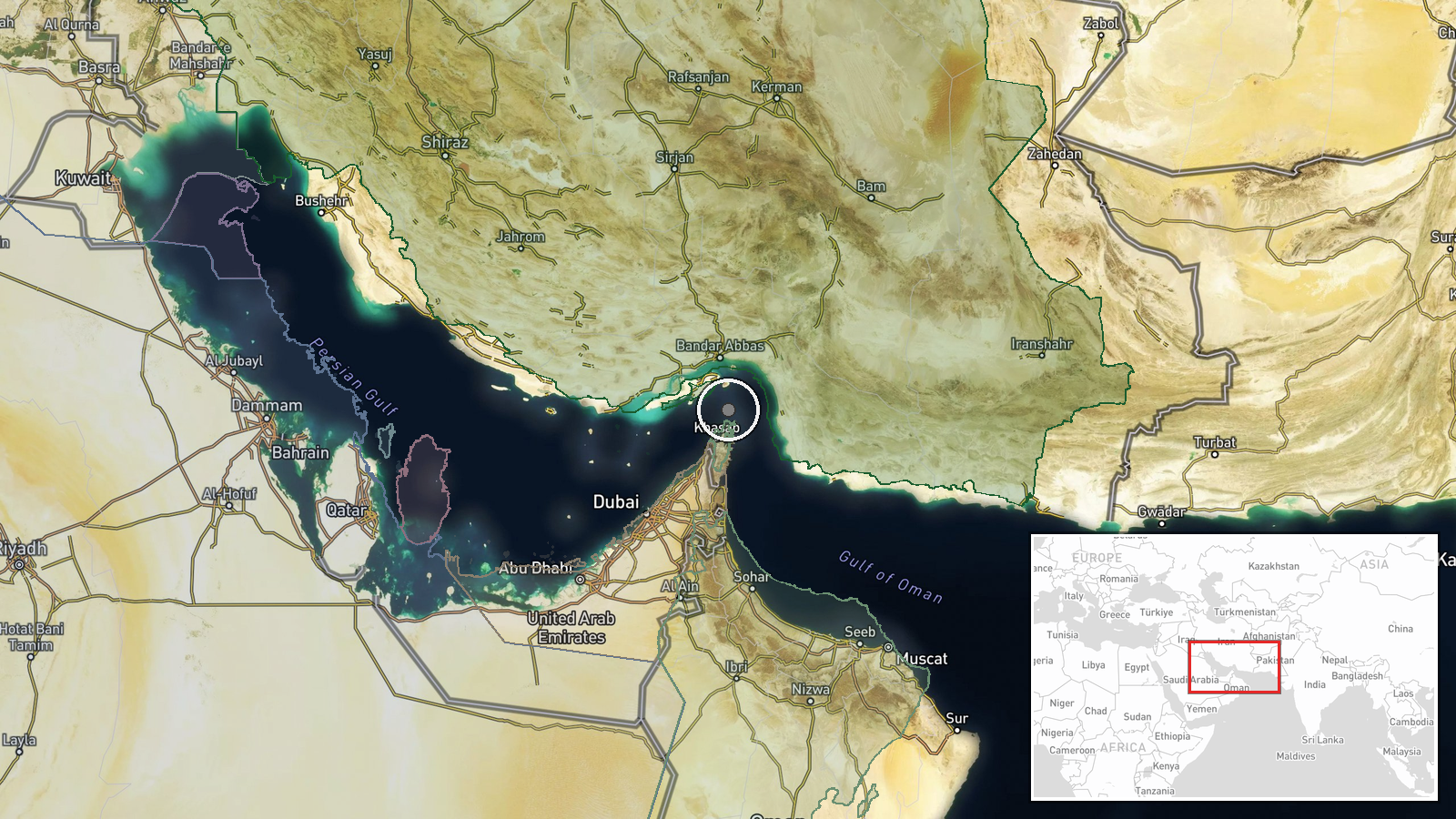
What happened
A single social media report on X described explosions and a possible ongoing naval engagement in the Strait of Hormuz on September 15 at approximately 20:59 UTC. No details were provided regarding the parties involved, the nature of the engagement, or outcomes. The report remains unconfirmed by official sources or independent corroboration.
Context and assessment
The reported explosions coincide with a sharp escalation in Strait of Hormuz activity on September 15. Earlier that day, a UAE-flagged oil tanker struck a naval mine south of the strait, Iranian forces conducted missile and drone strikes against the tanker El Gaia, and the U.S. Navy destroyed two Iranian Revolutionary Guard Corps (IRGC) boats after they allegedly attempted to seize an American unmanned surface vessel. Iran's IRGC also claimed downing a fourth U.S. MQ-1 Predator drone in four days. This pattern suggests sustained tension between U.S. and Iranian naval forces, with civilian shipping increasingly caught in the crossfire. The Strait of Hormuz remains a critical global chokepoint for oil transport.
Sources and confidence
Source is a single X account (@WarMonitor3) with no independent confirmation. No official military or government statements support the report. Confidence score of 6.0 reflects the lack of cross-confirmation and absence of verifiable details. Confirmation from CENTCOM, regional navies, shipping trackers, or additional independent sources would significantly raise confidence.
Location
The Strait of Hormuz, located between Iran and Oman at approximately 26.55°N, 56.4°E, connects the Persian Gulf to the Gulf of Oman and Indian Ocean. Precision is classified as regional rather than specific due to the report's vague wording. The area is a narrow shipping lane and historically contested waters where U.S., Iranian, and commercial maritime operations frequently intersect.
Related events nearby
- UAE-flagged oil tanker struck a naval mine while transiting south of Strait of Hormuz. Vessel damage status un2026-09-15 17:58 UTC · Cargo Ship · Strait of Hormuz, Persian Gulf
- U.S. Navy drone destroyed two IRGC boats in the Strait of Hormuz after they allegedly attempted to seize an Am2026-09-15 13:12 UTC · Naval · Strait of Hormuz, Persian Gulf
- Iranian missile and drone strikes on oil tanker El Gaia near Strait of Hormuz; vessel hit last month by missil2026-09-15 09:55 UTC · Ballistic Missile · Strait of Hormuz, Persian Gulf
- Iran's IRGC claims interception and destruction of a fourth U.S. MQ-1 Predator drone in four days east of the 2026-09-15 07:11 UTC · Drone Shootdown · East of Strait of Hormuz, Persian Gulf
- U.S. naval forces issued warning to Chinese-flagged vessel in Strait of Hormuz before engaging nearby oil tank2026-09-15 05:37 UTC · Naval · Strait of Hormuz, Persian Gulf
▶ View this event on the live map
Intel Mapper aggregates open-source reports from monitored Telegram and X channels, geolocates them, cross-checks duplicates across sources and assigns a confidence score. Entries are updated as new confirmations arrive. Read how we verify events.