Reported FPV drone strike on Russian Mi-28 helicopter near Yampil', Donetsk Oblast
What happened
A single account posted to X by the channel @ConflictTR states that Ukrainian forces targeted a Russian Mi-28 attack helicopter with an FPV kamikaze drone. The original Turkish post reads, in translation, that Ukrainian forces targeted the Russian helicopter with an FPV kamikaze UAV. The wording says 'targeted' rather than 'hit' or 'destroyed,' so the post does not establish that the aircraft was struck or damaged. The timestamp is 16 October 2026, 22:10 UTC. The location is given only as a front-line area near Yampil', Donetsk Oblast, and the outcome is not specified. No crew casualties, aircraft damage, or unit affiliation appear in the material available.
Context and assessment
The Mi-28 is a Russian attack helicopter built for close fire support, typically operating near the front to engage armour, positions, and infantry. Helicopters flying low near the line are exposed to short-range air defence, and small first-person-view drones have become a common threat to ground targets, with occasional reported use against aircraft at low altitude or at landing sites. The surrounding reports point to a busy northern Donetsk front on the same day. DeepState recorded a Russian advance of about 6 square kilometres in the Minkivka sector, the Ukrainian General Staff described repelled attacks on the Lyman and Sloviansk axes, and it reported 27 Russian attacks and 16 combat clashes around Kostiantynivka. Air monitoring also logged a guided glide bomb heading toward Donetsk Oblast. Taken together, this suggests heavy ground fighting in which attack helicopters may have been providing fire support. If the claim is accurate, it would point to Ukrainian drones being used against Russian aviation close to the line, though a single unconfirmed claim cannot establish how often this occurs or how effective it was.
Sources and confidence
The only source is the X account @ConflictTR, so the claim has not been cross-confirmed by a second independent channel. The related events come from other feeds, including the General Staff, DeepState, and air monitoring, but they describe ground activity on the same axes and do not corroborate the helicopter strike. The confidence score of 5.7 reflects a single-channel claim, an unspecified outcome, and a low-precision location. Confidence would rise with geolocated or time-stamped imagery of the helicopter or the attack, an official statement from either side, or confirmation from independent open-source analysts. It would fall if the imagery showed a different aircraft, a different date, or no damage.
Location
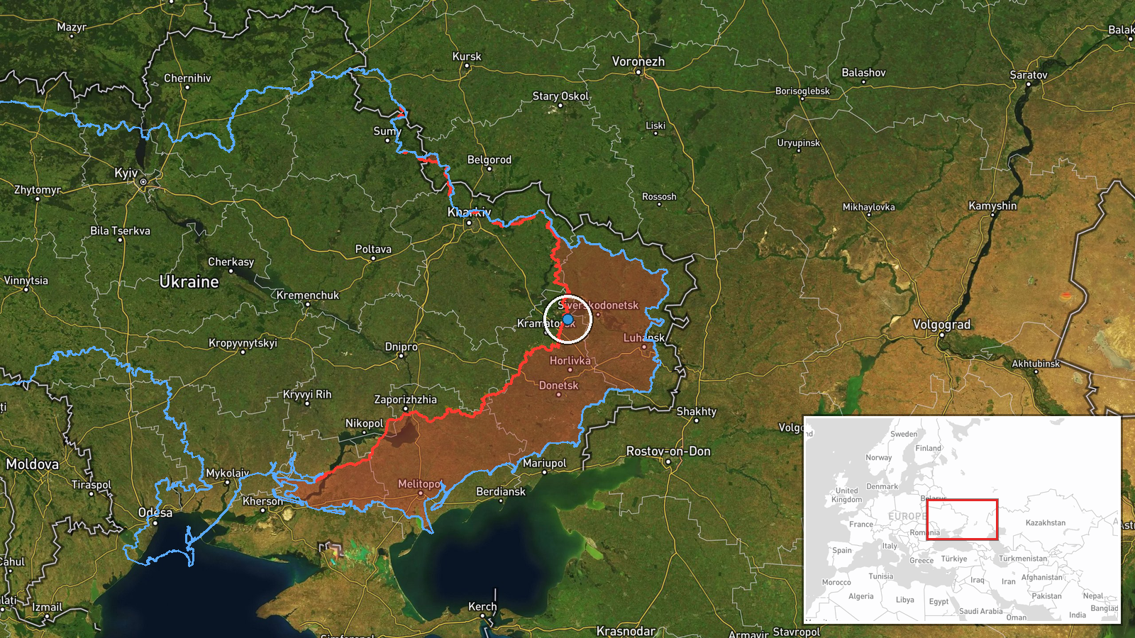
The location is recorded at region precision, with coordinates of roughly 48.894 N and 37.955 E. These are estimates placed near Yampil' in Donetsk Oblast rather than a confirmed site. The area is open steppe and farmland in northern Donetsk, with scattered villages, shallow river valleys, and tree belts that can conceal low-flying aircraft. The Lyman and Sloviansk axes lie nearby, so the exact position of the front in this sector matters for interpreting the report.
Related events nearby
- Russian forces advanced (~6 km²) in the Minkivka sector per DeepState frontline update. No settlement center c2026-10-16 00:20 UTC · Combat · Minkivka sector, Ukraine
- Ukrainian forces repelled eight Russian attacks on the Lyman axis and two on the Sloviansk axis, plus three at2026-10-16 05:05 UTC · Combat · Lyman, Donetsk Oblast, Ukraine
- Ukrainian General Staff reports 16 combat clashes on the Kostiantynivka axis by 22:00 on 16 Oct, near Kostiant2026-10-16 19:03 UTC · Combat · Kostiantynivka, Donetsk Oblast, Ukraine
- Ukrainian General Staff reports 27 Russian attacks on the Kostiantynivka direction, including assaults near Ko2026-10-16 05:06 UTC · Combat · Kostiantynivka, Donetsk Oblast, Ukraine
- Ukrainian air monitoring: 1 Russian guided glide bomb (KAB) heading toward Donetsk Oblast.2026-10-16 01:04 UTC · Airstrike · Donetsk Oblast, Ukraine
▶ View this event on the live map

Intel Mapper aggregates open-source reports from monitored Telegram and X channels, geolocates them, cross-checks duplicates across sources and assigns a confidence score. Entries are updated as new confirmations arrive. Read how we verify events.