Russian Geran-3 drone tracked approaching Dymer north of Kyiv
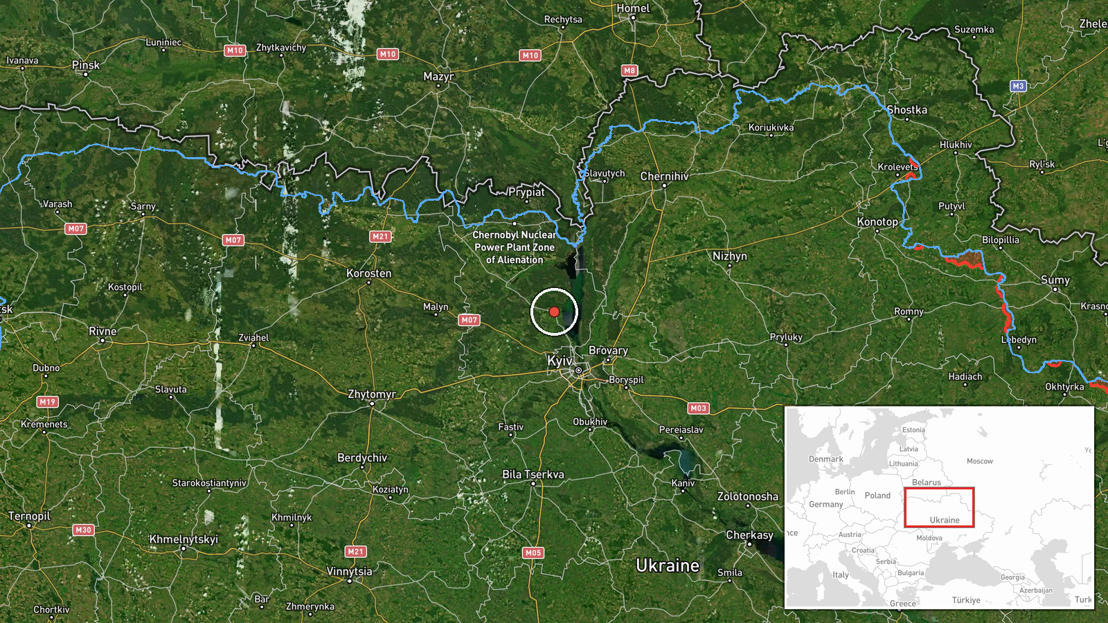
What happened
Ukrainian air monitoring reported a single Russian jet-powered Shahed (Geran-3) drone detected heading toward Dymer from the north on the morning of October 15, 2026, at 05:32 UTC. The report was issued via the official Telegram channel of Ukraine's air force command. Dymer lies approximately 40 kilometers north of Kyiv. The drone's trajectory placed it on an approach vector toward the settlement, though the report did not specify whether it reached its target or was intercepted.
Context and assessment
Dymer sits in the northern approaches to Kyiv and has been a recurring focus of Russian drone operations throughout the conflict. The October 15 attack was part of a broader coordinated wave: related reports document at least five additional Geran-3 drones transiting the same general area within hours, targeting Dymer, Vyshhorod, Borodianka, and Ivankiv—settlements arrayed in a rough arc north and northwest of the capital. This pattern suggests a multi-vector strike designed to test or overwhelm Ukrainian air defenses across the region. Geran-3 drones, equipped with turbojet engines, are designed for strikes on fixed infrastructure and represent a sustained Russian effort to degrade Ukrainian capabilities and civilian morale.
Sources and confidence
Reported solely by the official Telegram channel of Ukraine's Armed Forces General Staff (@kpszsu). No independent cross-confirmation from other channels or Ukrainian sources has been identified. Confidence is rated 8.0 (on a scale of 10) based on the source's official status and consistent reporting of similar drone activities; elevation would require verification from additional monitoring stations or Ukrainian air defense accounts.
Location
Dymer is a settlement in Kyiv Oblast, approximately 40 kilometers north-northwest of Kyiv city center, situated on the right bank of the Dnieper River. The town has historically served as a logistics hub and industrial area. The drone was reported approaching from the north, indicating it transited the open territory between Chornobyl and Kyiv before reaching Dymer's vicinity.
Related events nearby
- Ukrainian air monitoring: 2+ Russian jet-powered Shahed (Geran-3) drones heading toward Dymer.2026-10-15 06:05 UTC · Drone Transit · Dymer, Ukraine
- Ukrainian air monitoring: 1 Russian jet-powered Shahed (Geran-3) drone passing Pivnichnyi, heading toward Dyme2026-10-15 01:52 UTC · Drone Transit · Dymer, Ukraine
- Ukrainian air monitoring: 2+ Russian jet-powered Shahed (Geran-3) drones heading toward Vyshhorod.2026-10-15 05:36 UTC · Drone Transit · Vyshhorod, Ukraine
- Ukrainian air monitoring: 1 Russian jet-powered Shahed (Geran-3) drone heading toward Borodianka.2026-10-15 04:55 UTC · Drone Transit · Borodianka, Ukraine
- Ukrainian air monitoring: 1 Russian jet-powered Shahed (Geran-3) drone heading toward Borodianka.2026-10-15 01:53 UTC · Drone Transit · Borodianka, Ukraine
▶ View this event on the live map

Intel Mapper aggregates open-source reports from monitored Telegram and X channels, geolocates them, cross-checks duplicates across sources and assigns a confidence score. Entries are updated as new confirmations arrive. Read how we verify events.