Ukrainian air monitoring reports one Russian Shahed-type drone heading west over Dunaivtsi
What happened
Ukrainian air monitoring reported a single Russian Shahed-type strike drone tracked over Dunaivtsi, a town in Khmelnytskyi Oblast in western-central Ukraine, on 16 October 2026 at about 16:16 UTC. The drone was described as moving on a westward heading. The original Ukrainian-language post, published on the Telegram channel @kpszsu, labels the object a strike UAV ('ударний БпЛА') and gives the direction as 'курсом на захід', meaning toward the west. The report does not mention impact, damage, casualties, or air-defense engagement. It is a transit observation only, and the wording reflects a tracking notice rather than confirmed strike outcomes.
Context and assessment
Dunaivtsi has appeared several times in recent air-monitoring reports. A jet-powered Shahed, which Ukrainian reporting in this series identifies as the Geran-3 variant, was logged moving from Khmelnytskyi Oblast toward the town on 15 October at 16:37 UTC and again on 16 October at 01:05 UTC. Nearby Derazhnya, also in the oblast, was the target of several overlapping tracks over the same 36-hour window, including groups of two or more drones arriving from eastern Khmelnytskyi and Vinnytsia oblasts. Taken together, the pattern suggests Russian long-range drones were moving through the region along corridors that cross the oblast's central and western areas. Whether the drones were headed for a specific installation, were being routed onward to other targets, or were simply transiting is not stated in the data. Repeated tracks over the same settlements often reflect the flight path of a broader raid rather than a single aim point, so the westward heading here may mark the drone's exit from the area rather than its destination.
Sources and confidence
The event rests on one Telegram post from @kpszsu, which is widely associated with the Ukrainian Air Force's official reporting. No second independent channel or outlet in the dataset confirms the track, so the report is single-source. The confidence score of 8.0 reflects a credible official-style channel with a clear, time-stamped observation and consistent wording with related tracks. It is not higher because the observation is brief, lacks corroboration, and carries no independent imagery. Confidence would rise if a second monitoring source or regional military administration reported the same track, or if wreckage or impact were documented. It would fall if later updates reclassified the object or retracted the track.
Location
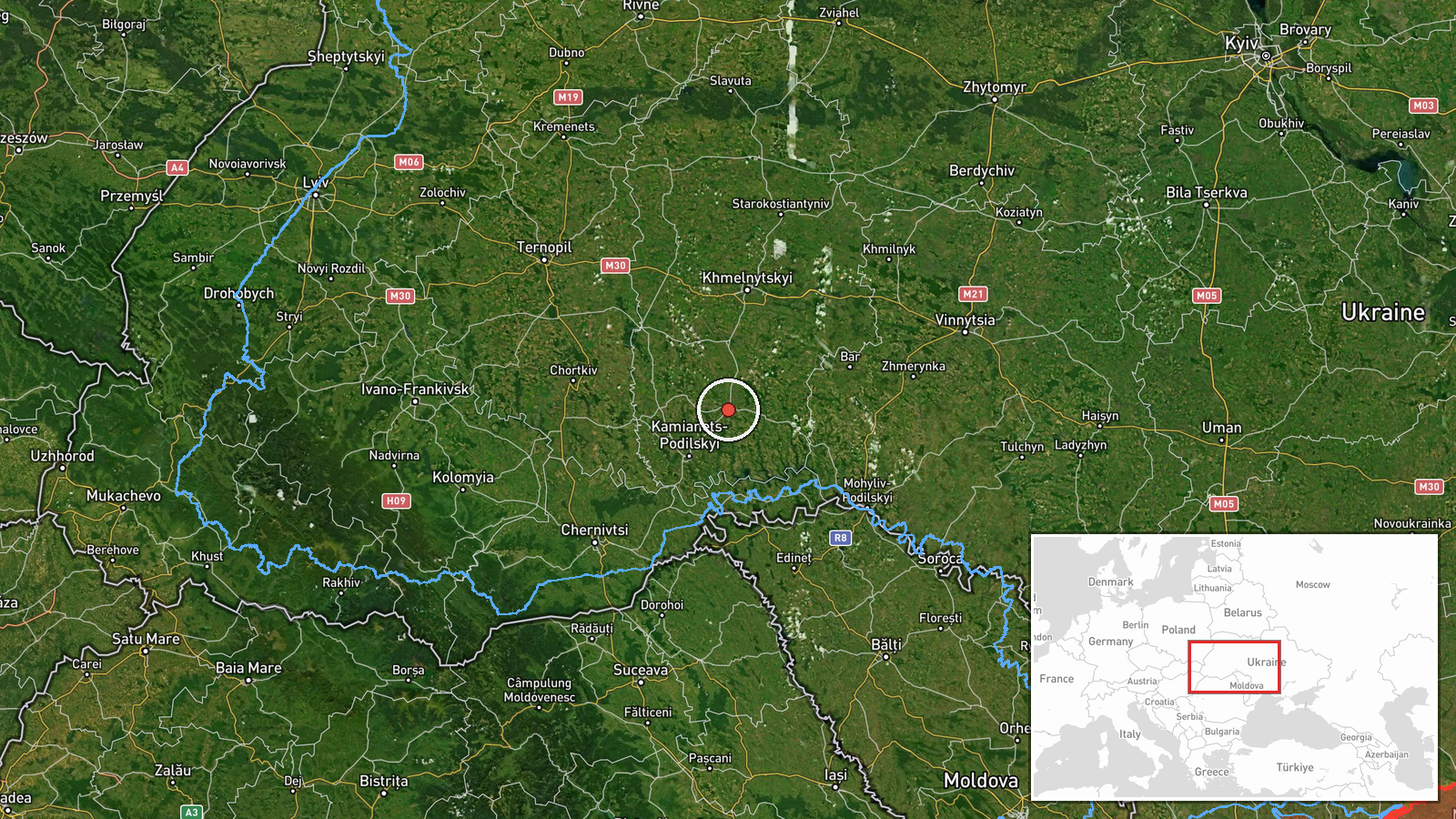
The location is recorded at settlement level, and the dataset's coordinates place the marker at the centre of Dunaivtsi, with high location confidence. Dunaivtsi is a small town in Khmelnytskyi Oblast, in the historical Podolia region, in western-central Ukraine. The surrounding area is mostly agricultural lowland with scattered towns and rural settlements. The marker reflects the town as a whole rather than any specific facility, because the source does not name one.
Related events nearby
- Ukrainian air monitoring: 1 Russian jet-powered Shahed (Geran-3) drone from Khmelnytskyi Oblast toward Dunayiv2026-10-16 01:05 UTC · Drone Transit · Dunayivtsi, Ukraine
- Ukrainian air monitoring: 2+ Russian jet-powered Shahed (Geran-3) drones from Vinnytsia Oblast toward Derazhny2026-10-16 10:47 UTC · Drone Transit · Derazhnya, Ukraine
- Ukrainian air monitoring: 2+ Russian jet-powered Shahed (Geran-3) drones from eastern Khmelnytskyi Oblast towa2026-10-16 04:20 UTC · Drone Transit · Derazhnya, Ukraine
- Ukrainian air monitoring: 1 Russian jet-powered Shahed (Geran-3) drone from Vinnytsia Oblast toward Derazhnya.2026-10-15 17:30 UTC · Drone Transit · Derazhnya, Ukraine
- Ukrainian air monitoring: 1 Russian Shahed-type drone passing Tyvriv, heading toward Khmelnytskyi Oblast.2026-10-16 11:46 UTC · Drone Transit · Khmelnytskyi Oblast, Ukraine
▶ View this event on the live map

Intel Mapper aggregates open-source reports from monitored Telegram and X channels, geolocates them, cross-checks duplicates across sources and assigns a confidence score. Entries are updated as new confirmations arrive. Read how we verify events.