Single Shahed-type drone reported near Tetiiv, heading toward Vinnytsia Oblast
What happened
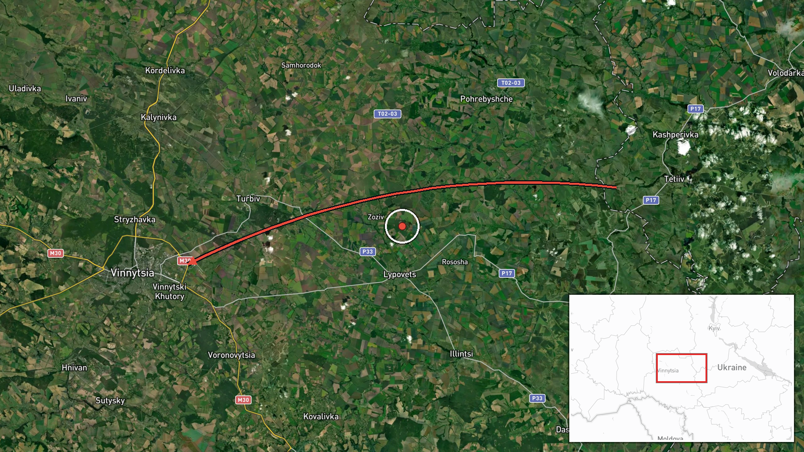
Ukrainian air monitoring reported on 17 October 2026 at 05:32 UTC that one Russian Shahed-type drone was passing near Tetiiv and heading toward Vinnytsia Oblast. The source, a Telegram channel linked to Ukraine's air force monitoring, described the object as a UAV in the Kyiv region before its track shifted toward Vinnytsia. The original Ukrainian wording, 'БпЛА в районі Тетієва, курсом на Вінниччину,' is terse and gives no altitude, speed, or intended target. The report does not say whether the drone was shot down, lost from tracking, or reached Vinnytsia. Attribution to Russia rests on the drone type rather than on recovered wreckage. The event is logged as a drone transit, meaning a sighting of an airborne object on a track, not a confirmed strike.
Context and assessment
Vinnytsia appears repeatedly in the preceding hours. On 16 October, reports described a drone passing Vinnytsia Oblast and heading west while another moved toward Zhytomyr Oblast, followed by a single drone at 18:36 UTC heading toward Vinnytsia. A drone passing Tulchyn at 19:59 was also logged as bound for the city, and another followed at 20:12. Shortly after 02:41 UTC on 17 October, a report described two or more jet-powered Geran-3 drones on the same approach. The sequence suggests a sustained stream of single and small-group tracks routed through the Vinnytsia corridor over roughly twelve hours. Vinnytsia is a regional administrative centre in west-central Ukraine with road and rail junctions, so repeated tracks toward it are notable. Operationally, such a pattern may reflect long-range flights passing through the area, reconnaissance or probing of air defence responses, or diversionary routing. The data cannot distinguish between these explanations, and the reports do not confirm any impact or intended target.
Sources and confidence
This event rests on one channel, Telegram @kpszsu, with no cross-confirmation in the dataset and a source count of one. The confidence score of 8.0 reflects the channel's official air monitoring role and its consistency with several related drone-transit reports in the same hours. It is held below the top of the range because nothing independently verifies this specific track. Confidence would rise with corroboration from regional military administrations, a follow-up air force update, or reports of interception or debris. It would fall if the event were corrected or retracted, or if later tracking showed the object was a different flight. The record is currently marked as not corrected.
Location
The coordinates (49.23, 28.47) are placed at region precision with low location confidence, so the marker shows an approximate area of Vinnytsia Oblast rather than a specific settlement. Tetiiv itself lies farther north-east in Kyiv Oblast, on the Ros River, so the marker should not be read as the reported point of passage. The surrounding terrain is largely agricultural, with river valleys and forest belts typical of central Ukraine. No facility or precise track point is identified in the data.
Related events nearby
- Ukrainian air monitoring: 1 Russian jet-powered Shahed (Geran-3) drone passing Vinnytsia Oblast, heading north2026-10-17 06:25 UTC · Drone Transit · Vinnytsia Oblast, Ukraine
- Ukrainian air monitoring: 2+ Russian jet-powered Shahed (Geran-3) drones heading toward Vinnytsia.2026-10-17 02:41 UTC · Drone Transit · Vinnytsia, Ukraine
- Ukrainian air monitoring: 1 Russian Shahed-type drone heading toward Vinnytsia.2026-10-16 20:12 UTC · Drone Transit · Vinnytsia, Ukraine
- Ukrainian air monitoring: 1 Russian Shahed-type drone passing Tulchyn, heading toward Vinnytsia.2026-10-16 19:59 UTC · Drone Transit · Vinnytsia, Ukraine
- Ukrainian air monitoring: 1 Russian Shahed-type drone heading toward Vinnytsia.2026-10-16 18:36 UTC · Drone Transit · Vinnytsia, Ukraine
▶ View this event on the live map

Intel Mapper aggregates open-source reports from monitored Telegram and X channels, geolocates them, cross-checks duplicates across sources and assigns a confidence score. Entries are updated as new confirmations arrive. Read how we verify events.