Russian jet-powered Shahed drones reported transiting western Chernihiv Oblast, heading south
What happened
Ukrainian air monitoring reported two or more Russian jet-powered Shahed (Geran-3) drones passing through western Chernihiv Oblast in the early hours of 19 October 2026, heading south. The report was posted at 02:44 UTC and uses the wording of a short Ukrainian-language alert, which translates roughly as jet-type unmanned aerial vehicles over western Chernihiv region on a southerly course. The alert does not give altitude, speed, or any intended target, and it reports no impact or damage. The event is recorded as a transit rather than a strike. The only source is a single Telegram channel, @kpszsu, which is reportedly the Ukrainian Air Force's monitoring account.
Context and assessment
This report sits within a cluster of aerial activity across northern Ukraine over roughly 24 hours. At 05:57 UTC on 18 October, two or more Geran-3 drones passed northern Kyiv Oblast heading west. Around 07:30 that morning, a single Shahed-type drone passed Slavutych, and at 07:58 a Banderol mini cruise missile was reported passing Berezna toward Chernihiv. At 02:45 on 19 October, one Geran-3 passed northern Kyiv Oblast heading west, and at 02:44 a single Shahed-type drone was reported moving from Sumy Oblast toward Chernihiv Oblast. The mix of drone types, the staggered timing, and the repeated northern corridors suggest sustained use of routes that run close to the Belarus and Sumy borders. The southerly heading of this group may indicate movement toward central or southern areas, though a transit alert cannot confirm the destination. Because the same region saw a cruise missile hours earlier, the pattern is consistent with ongoing pressure on the Chernihiv area, but that inference rests on timing and direction alone.
Sources and confidence
All details come from one Telegram channel, @kpszsu, and no other outlet or official feed in the dataset independently confirms the sighting. The confidence score of 8.0 reflects the channel's official character, the specific timing, and the consistency of the alert with the surrounding pattern of reports. It is held below the maximum because the report is single-sourced, gives only a region rather than a precise track, and carries a low location confidence. Corroboration from Chernihiv regional authorities, other monitoring channels, or subsequent impact reports would raise confidence. A correction, a revised track, or a clear mismatch with other sightings would lower it.
Location
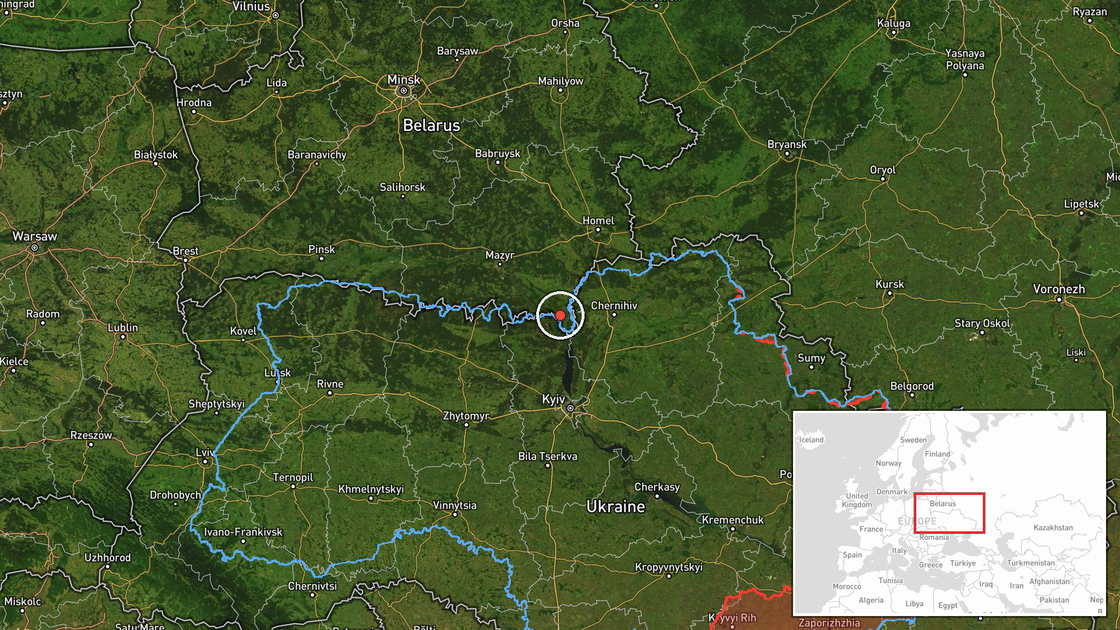
The coordinates (51.49 N, 30.335 E) are a regional-level point, not a settlement or facility. The alert named western Chernihiv Oblast without a specific town, so the position is an approximate centroid for that area. The setting is the Polissia lowlands in northern Ukraine, a region of forests, wetlands and river valleys close to the Belarusian border. Nearby reported locations in the wider cluster include Slavutych and Berezna, which are not the point of this report.
Related events nearby
- Ukrainian air monitoring: 1 Russian Shahed-type drone passing western Chernihiv Oblast, heading south; 1 Russi2026-10-19 03:57 UTC · Drone Transit · western Chernihiv Oblast, Ukraine
- Ukrainian air monitoring: 1 Russian Shahed-type drone passing Slavutych, heading south.2026-10-18 07:30 UTC · Drone Transit · Slavutych, Ukraine
- Ukrainian air monitoring: 1 Russian jet-powered Shahed (Geran-3) drone passing northern Kyiv Oblast, heading w2026-10-19 02:45 UTC · Drone Transit · northern Kyiv Oblast, Ukraine
- Ukrainian air monitoring: 2+ Russian jet-powered Shahed (Geran-3) drones passing northern Kyiv Oblast, heading2026-10-18 05:57 UTC · Drone Transit · northern Kyiv Oblast, Ukraine
- Ukrainian air monitoring: 1 Russian Shahed-type drone from Sumy Oblast toward Chernihiv Oblast.2026-10-19 02:44 UTC · Drone Transit · Chernihiv Oblast, Ukraine
▶ View this event on the live map

Intel Mapper aggregates open-source reports from monitored Telegram and X channels, geolocates them, cross-checks duplicates across sources and assigns a confidence score. Entries are updated as new confirmations arrive. Read how we verify events.