Jet-powered Shahed-type drone reported over northern Zaporizhzhia Oblast, heading west
What happened
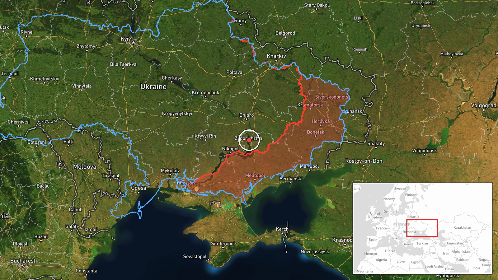
Ukrainian air monitoring channel @kpszsu reported at 02:44 UTC on 19 October 2026 that one jet-powered Shahed-type drone, described as a Geran-3, was passing over northern Zaporizhzhia on a westward course. The original Ukrainian-language post is brief and names no impact point, debris site, or casualties. It also does not say whether the drone was intercepted or where it was later tracked. The notice is a transit report rather than a strike report. Its wording specifies a jet-powered aircraft, which is more precise than the generic Shahed-type label used in several earlier notices in the same window.
Context and assessment
Zaporizhzhia city and its surrounding oblast have appeared repeatedly in this sequence. On 18 October at 06:17 UTC a Shahed-type drone was reported heading toward Zaporizhzhia, and at 07:18 UTC a guided glide bomb was reported on a similar track. On 19 October, between 02:42 and 02:46 UTC, separate notices described a glide bomb heading toward southern Dnipropetrovsk Oblast, another toward Zaporizhzhia Oblast, and a ballistic missile toward Zaporizhzhia city. Read together, the pattern suggests a layered approach in which long-range drones, standoff glide bombs and ballistic missiles are used against the same broad area within a short period. The drone reported here crosses the north of the oblast rather than approaching the city directly, so its intended target is not established by the data. One possibility is that it was routed along a corridor toward areas further west, another is that it formed part of a wider salvo whose other elements were reported separately. Neither reading can be confirmed from a single transit notice.
Sources and confidence
All information comes from one Telegram channel, @kpszsu, with no second source in the dataset confirming the track, aircraft type or timing. The related events share the same type of monitoring notice and therefore do not provide independent corroboration. The confidence score of 8.0 reflects the official nature of the channel and the specificity of the message, tempered by the single-source status and the absence of imagery or an official statement. Confidence would rise with a second independent monitoring feed, an official air force statement, or reports of interception or impact that match the track. It would fall if the channel corrected or withdrew the aircraft classification, or if later reporting placed the drone in a different area.
Location
The coordinates are a generalised regional marker for northern Zaporizhzhia Oblast, not a settlement, facility or confirmed drone position, and the location confidence is recorded as low. The surrounding terrain is mainly open steppe and farmland, with the Dnipro River system and its reservoirs lying to the east and the city of Zaporizhzhia to the south. The point should be read as indicating a general area only.
Related events nearby
- Ukrainian air monitoring: 1 Russian ballistic missile heading toward Zaporizhzhia.2026-10-19 02:46 UTC · Ballistic Missile · Zaporizhzhia, Ukraine
- Ukrainian air monitoring: 1 Russian guided glide bomb (KAB) heading toward Zaporizhzhia.2026-10-18 07:18 UTC · Airstrike · Zaporizhzhia, Ukraine
- Ukrainian air monitoring: 1 Russian Shahed-type drone heading toward Zaporizhzhia.2026-10-18 06:17 UTC · Drone Transit · Zaporizhzhia, Ukraine
- Ukrainian air monitoring: 1 Russian guided glide bomb (KAB) heading toward Zaporizhzhya Oblast.2026-10-19 03:22 UTC · Airstrike · Zaporizhzhya Oblast, Ukraine
- Ukrainian air monitoring: 1 Russian guided glide bomb (KAB) heading toward Zaporizhzhya Oblast.2026-10-19 02:46 UTC · Airstrike · Zaporizhzhya Oblast, Ukraine
▶ View this event on the live map

Intel Mapper aggregates open-source reports from monitored Telegram and X channels, geolocates them, cross-checks duplicates across sources and assigns a confidence score. Entries are updated as new confirmations arrive. Read how we verify events.