Jet-powered Shahed drones reported heading toward Kyiv Oblast from Chernihiv and Mykolaiv areas
What happened
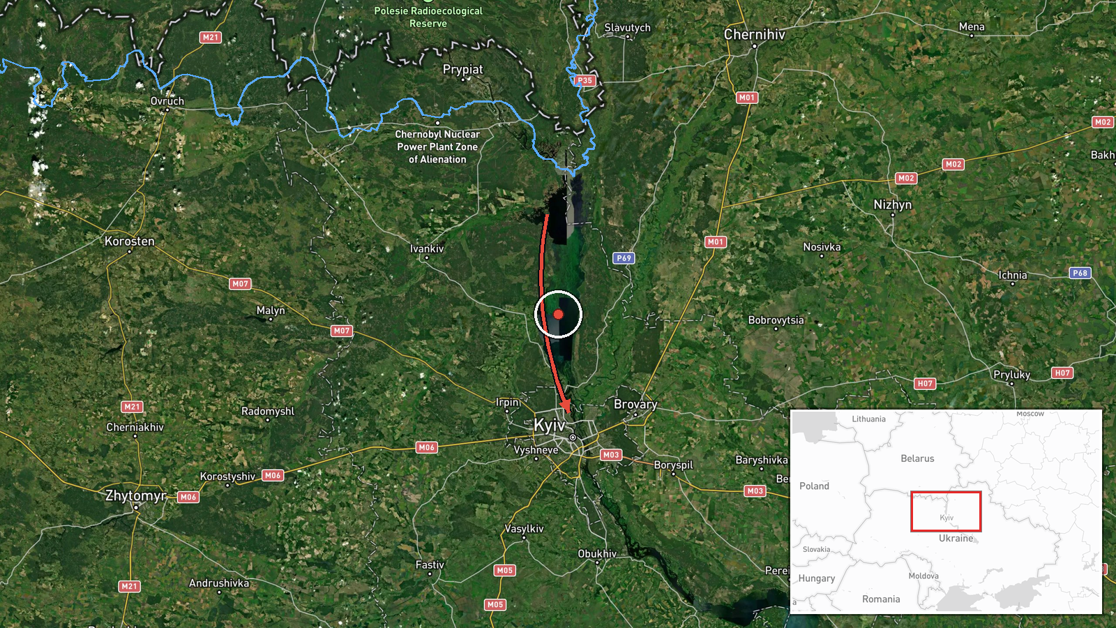
Ukraine's Air Force monitoring channel on Telegram, @kpszsu, reported on 20 October 2026 at 06:22 UTC two separate sightings of Russian jet-powered Shahed (Geran-3) drones. The first described one drone in western Chernihiv Oblast on a course toward Kyiv Oblast. The second described one drone over southern Mykolaiv Oblast moving north. The Ukrainian-language posts describe the aircraft as reactive UAVs, marked with a jet icon, and give direction only. They include no timestamps for the individual tracks, no impact points and no damage reports. The report does not say whether the two drones are linked or what, if anything, they struck. Both entries are classed as drone transits, meaning airborne movement rather than a confirmed strike.
Context and assessment
Kyiv Oblast sits at the centre of a sustained run of similar reports. Between 20:55 UTC on 19 October and 06:10 UTC on 20 October, the same channel logged at least six further Geran-3 transits. These began with three or more drones from northern Chernihiv Oblast heading toward Kyiv Oblast, followed by single drones passing Vyshhorod and then heading toward Kyiv itself. The pattern is a steady corridor running from the Chernihiv side toward the capital. Chernihiv's border position makes it a common entry axis for flights toward Kyiv, and Vyshhorod, north of the city on the Dnipro, lies on that approach. The southern Mykolaiv track follows a different corridor, moving north from the Black Sea coast region, and is not described as joining the Kyiv group. Operationally, a series of single-drone reports across several hours is consistent with launches staggered along different routes, possibly to stretch air defence attention. The posts cannot show intent or whether the drones were later engaged. Reports of this type are monitoring entries, not evidence of a strike.
Sources and confidence
The event rests on a single channel, the Telegram account @kpszsu, which is associated with Ukraine's Air Force. No second outlet, wire service or independent tracker in the data corroborates either track. The score of 8.0 reflects an official military channel posting in near real time. It is not higher because the posts give no per-track timestamps, no independent confirmation of routes and no follow-up on outcomes. Confidence would rise if regional administrations, independent trackers or later Air Force updates confirmed the paths. It would fall if the drones were reported shot down elsewhere or the track was revised.
Location
The location is approximate, marked at region precision with low location confidence. The coordinates, 50.45 N and 30.52 E, correspond to Kyiv city rather than a specific point in Kyiv Oblast, because the posts name only oblasts and compass directions. No settlement or facility is named. Kyiv Oblast surrounds the capital and includes the Dnipro river corridor and the wooded and marshy Polissia terrain to the north. Mykolaiv Oblast lies on the Black Sea coast to the south.
Related events nearby
- Ukrainian air monitoring: 1 Russian jet-powered Shahed (Geran-3) drone heading toward Kyiv.2026-10-20 06:10 UTC · Drone Transit · Kyiv, Ukraine
- Ukrainian air monitoring: 1 Russian jet-powered Shahed (Geran-3) drone passing Vyshhorod, heading toward Kyiv.2026-10-19 23:55 UTC · Drone Transit · Kyiv, Ukraine
- Ukrainian air monitoring: 1 Russian jet-powered Shahed (Geran-3) drone heading toward Kyiv Oblast.2026-10-19 23:36 UTC · Drone Transit · Kyiv Oblast, Ukraine
- Ukrainian air monitoring: 1 Russian jet-powered Shahed (Geran-3) drone from Chernihiv Oblast toward Kyiv Oblas2026-10-19 23:04 UTC · Drone Transit · Kyiv Oblast, Ukraine
- Ukrainian air monitoring: 3+ Russian jet-powered Shahed (Geran-3) drones from northern Chernihiv Oblast toward2026-10-19 20:55 UTC · Drone Transit · Kyiv Oblast, Ukraine
▶ View this event on the live map

Intel Mapper aggregates open-source reports from monitored Telegram and X channels, geolocates them, cross-checks duplicates across sources and assigns a confidence score. Entries are updated as new confirmations arrive. Read how we verify events.