Ukrainian air monitoring reports two jet-powered Shahed drones passing Bereznehuvate heading north
What happened
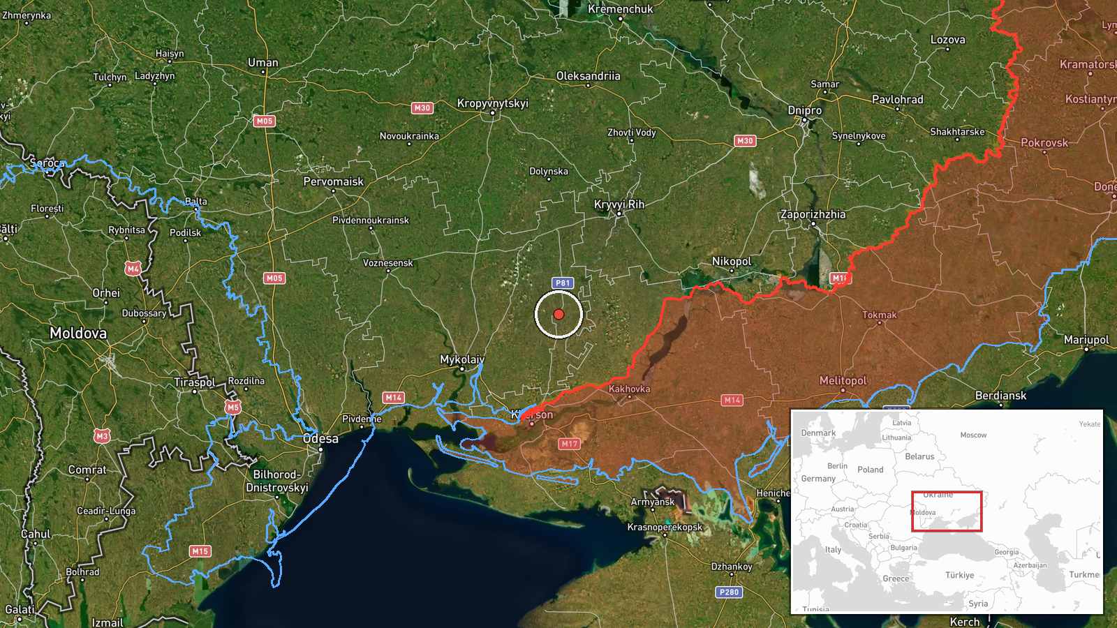
Ukrainian air monitoring posted on Telegram channel @kpszsu on 21 October 2026 at about 05:58 UTC that two or more Russian jet-powered Shahed (Geran-3) drones were passing Bereznehuvate in Mykolaiv Oblast, on a northerly course. The original Ukrainian-language post uses the phrase 'реактивні БпЛА', meaning jet-powered unmanned aerial vehicles, and gives the heading as 'курс північний', or north. The report describes transit only. It does not mention impacts, casualties, or damage, and no independent confirmation of the flight path or any strike was found in the data provided.
Context and assessment
Bereznehuvate lies in southern Mykolaiv Oblast, in the corridor between the Black Sea coast and the Dnipro-linked industrial belt around Kryvyi Rih. Drones passing through this area are part of a broader pattern of long-range strike traffic moving over southern Ukraine. The related events in the data show a run of similar transit reports over the previous day, including single Shahed-type drones over Mykolaiv, one heading toward Kharkiv, one toward Kryvyi Rih, one toward Voznesensk, and two passing southern Mykolaiv Oblast on westerly or unspecified headings. The Geran-3 designation refers to a jet-powered variant of the Shahed design, which is generally faster than the older piston-engine model and is commonly used in mass salvos alongside decoys. Operationally, a northbound track through Bereznehuvate could indicate drones routed toward northern or central Ukraine, or drones being redirected after earlier tracks. Because the reports describe drones that were only observed in transit, the data does not establish their intended target.
Sources and confidence
The only source is a single Telegram channel, @kpszsu, which is associated with Ukrainian air monitoring reporting. The confidence score of 8.0 reflects a credible official-style channel with a precise location and a consistent pattern of similar reports, but it is not cross-confirmed by a second independent outlet or by an observed impact. Confidence would rise with corroboration from other Ukrainian military or regional authorities, radar-based tracking, or reports of debris or impacts along the northern track. It would fall if later updates contradicted the heading, or if the drones were identified as decoys or a different system.
Location
The event is placed at the settlement level for Bereznehuvate, Ukraine, at coordinates 47.309 N, 32.851 E, which matches the town rather than a specific facility. The location was assigned with high confidence because the source names the settlement directly. The area is flat steppe farmland typical of southern Ukraine, with river valleys and a dense network of rural roads and agricultural settlements. The nearby Inhulets river corridor and the approaches to Kryvyi Rih lie to the north, which helps explain why the route is relevant to northbound movement.
Related events nearby
- Ukrainian air monitoring: 1 Russian jet-powered Shahed (Geran-3) drone heading toward Mykolaiv.2026-10-21 06:13 UTC · Drone Transit · Mykolaiv, Ukraine
- Ukrainian air monitoring: 1 Russian Shahed-type drone heading toward Kryvyi Rih.2026-10-20 09:52 UTC · Drone Transit · Kryvyi Rih, Ukraine
- Ukrainian air monitoring: 1 Russian jet-powered Shahed (Geran-3) drone heading toward Voznesensk.2026-10-20 15:20 UTC · Drone Transit · Voznesensk, Ukraine
- Ukrainian air monitoring: 1 Russian jet-powered Shahed (Geran-3) drone passing southern Mykolaiv Oblast, headi2026-10-20 07:30 UTC · Drone Transit · southern Mykolaiv Oblast, Ukraine
- Ukrainian air monitoring: 1 Russian jet-powered Shahed (Geran-3) drone heading toward southern Mykolaiv Oblast2026-10-20 07:00 UTC · Drone Transit · southern Mykolaiv Oblast, Ukraine
▶ View this event on the live map

Intel Mapper aggregates open-source reports from monitored Telegram and X channels, geolocates them, cross-checks duplicates across sources and assigns a confidence score. Entries are updated as new confirmations arrive. Read how we verify events.