Ukrainian air monitoring reports 2+ jet-powered Shahed drones heading toward Kryvyy Rih
What happened
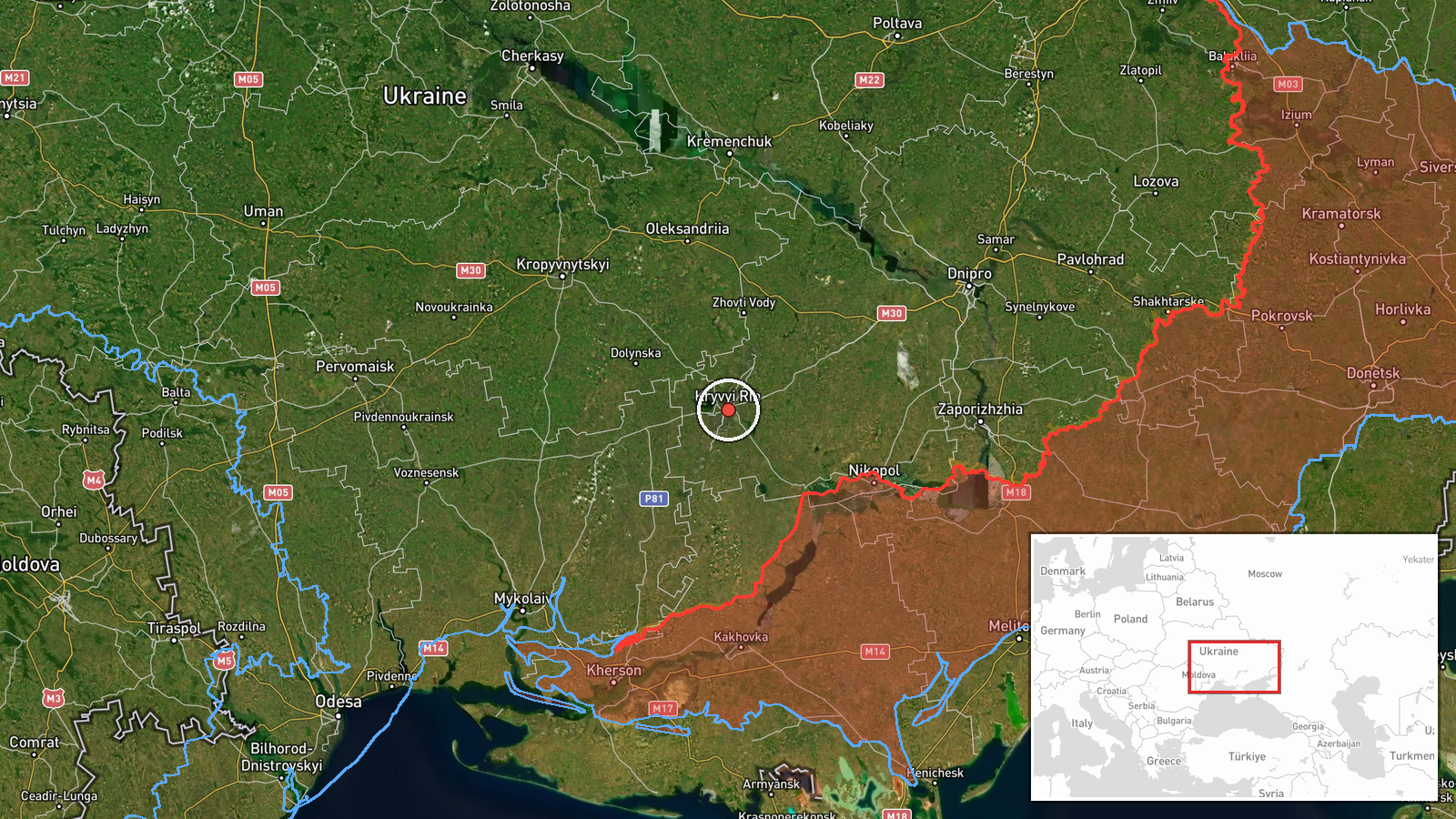
Ukraine's air monitoring channel, the Telegram account @kpszsu, reported on 21 October 2026 at about 15:48 UTC that two or more Russian jet-powered Shahed (Geran-3) drones were heading toward Kryvyy Rih in Dnipropetrovsk Oblast, central Ukraine. The original post, written in Ukrainian, was a short alert headlined as jet-type drones bound for Kryvyy Rih and Rivne. The report describes a drone in transit rather than a confirmed strike, and it does not state impact, casualties, or damage. Because the alert is a single-channel report, its wording reflects the monitoring service's initial assessment and has not been independently confirmed.
Context and assessment
Kryvyy Rih is a large industrial city and a longstanding focus of Russian long-range strikes, given its steel and mining base and its position on the central Ukrainian corridor. The alert fits a broader daytime pattern on the same date. Earlier reports placed Geran-3 drones passing Bereznehuvate heading north at 05:58 UTC, over Solone at 11:41, toward Kropyvnytskyi at 12:08, and across Kirovohrad Oblast from Mykolaiv Oblast at 06:23 and 13:06. The sequence suggests a series of drones entering from the south and moving northward through central Ukraine, with Kryvyy Rih appearing as one of several possible endpoints. Operationally, such routing may indicate either a sustained wave aimed at multiple urban targets or drones being redirected as air defenses respond. Transit reports of this kind are useful for warning, but the final target of any individual drone is often not clear from tracking alone.
Sources and confidence
The report rests on one Telegram channel, @kpszsu, which is the official Ukrainian air force monitoring account and is generally regarded as a primary source for airborne threat alerts. No second independent channel is listed for this event. The confidence score of 8.0 is relatively high because the source is official and the related events show a consistent, time-stamped pattern. It is not higher because the event is a single transit alert without confirmed impact. Confidence would rise with corroboration from local Dnipropetrovsk officials, impact reports, or imagery. It would fall if later updates retracted the drone count or the destination.
Location
The location is set at the settlement level for Kryvyy Rih, Ukraine, with high location confidence, which indicates the coordinates mark the city centre rather than a specific facility. Kryvyy Rih is a long, narrow city stretching along the Ingulets River valley in Dnipropetrovsk Oblast, in the steppe of central Ukraine. The city is known for its iron ore mines and steelworks, and its extended urban footprint means that a settlement-level point can differ from the actual location of any drone or impact.
Related events nearby
- Ukrainian air monitoring: 2+ Russian jet-powered Shahed (Geran-3) drones passing Bereznehuvate, heading north.2026-10-21 05:58 UTC · Drone Transit · Bereznehuvate, Ukraine
- Ukrainian air monitoring: 1 Russian jet-powered Shahed (Geran-3) drone heading toward Kropyvnytskyi.2026-10-21 16:03 UTC · Drone Transit · Kropyvnytskyi, Ukraine
- Ukrainian air monitoring: 1 Russian jet-powered Shahed (Geran-3) drone heading toward Kropyvnytskyi.2026-10-21 12:08 UTC · Drone Transit · Kropyvnytskyi, Ukraine
- Ukrainian air monitoring: 2+ Russian jet-powered Shahed (Geran-3) drones from western Dnipropetrovsk Oblast to2026-10-21 16:40 UTC · Drone Transit · Kirovohrad Oblast, Ukraine
- Ukrainian air monitoring: 1 Russian jet-powered Shahed (Geran-3) drone from northern Mykolaiv Oblast toward Ki2026-10-21 13:06 UTC · Drone Transit · Kirovohrad Oblast, Ukraine
▶ View this event on the live map

Intel Mapper aggregates open-source reports from monitored Telegram and X channels, geolocates them, cross-checks duplicates across sources and assigns a confidence score. Entries are updated as new confirmations arrive. Read how we verify events.