Single Russian Shahed-type drone reported heading toward Mena in Chernihiv Oblast
What happened
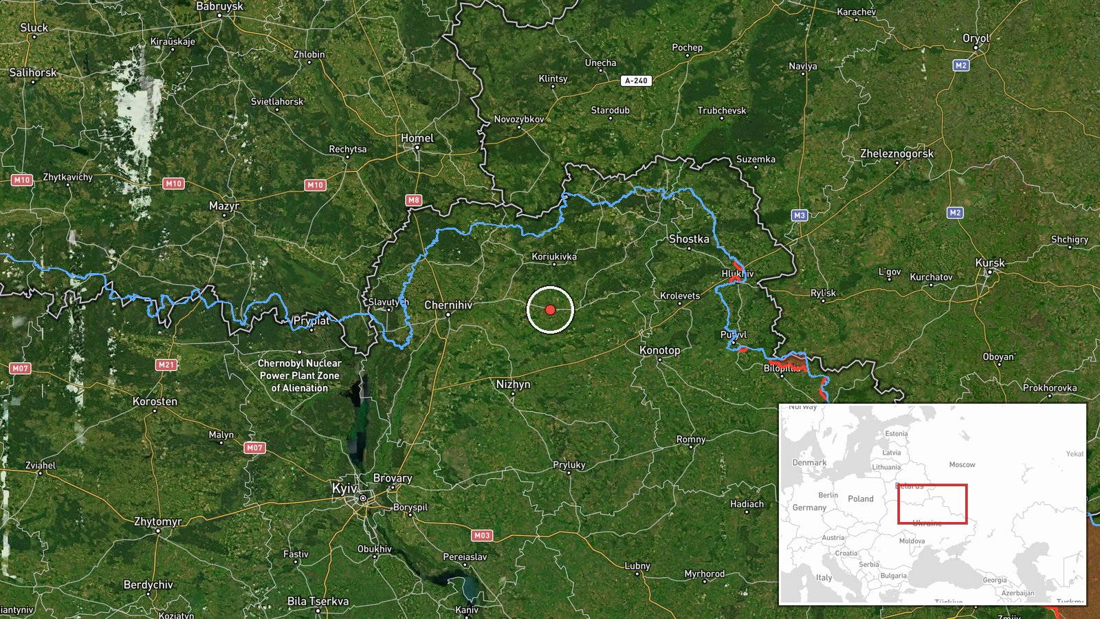
Ukrainian air monitoring reported on Telegram that one Russian Shahed-type drone was moving toward Mena, a town in Chernihiv Oblast in northern Ukraine, on 22 October 2026 at about 16:59 UTC. The original post, published by the air monitoring channel @kpszsu, was brief and in Ukrainian, describing a UAV on a course toward Mena with an accompanying emoji and the oblast name. The wording indicates a drone in transit rather than a confirmed strike, and the report contains no information on impact, damage, or casualties. The single post is the only source for this entry, and no independent outlet had reported the same track at the time of compilation. The event is classified as a drone transit warning.
Context and assessment
Mena sits close to the Russian border in northern Chernihiv Oblast, an area that has seen repeated drone and missile traffic since 2022 as aircraft and loitering munitions cross from Russian airspace toward Kyiv, Chernihiv city and the surrounding settlements. The related events in this dataset show a dense sequence over roughly thirty hours. On 21 October a jet-powered Geran-3 was tracked toward Chernihiv city, and on the morning of 22 October groups of two or more Geran-3 and Shahed-type drones were reported over northern Chernihiv Oblast and then toward Slavutych, a city farther east that hosts the Chernobyl exclusion zone workforce. A Banderol mini cruise missile was also reported toward Pryluky at 08:04. Taken together, the pattern suggests a sustained multi-axis raid moving across the oblast, with individual settlements receiving warnings as tracks shift. Operationally, a single drone heading toward a small town may be a flanking or dispersal element, a decoy, or simply one track within a larger wave. Air monitoring warnings of this kind mainly serve to alert civil defence and do not by themselves indicate intended targets. Whether this track was part of a coordinated salvo can only be judged once more reports from the same window are compared.
Sources and confidence
The entry rests on one Telegram channel, @kpszsu, which relays Ukrainian air monitoring alerts. No second channel, wire service or official statement in the dataset confirms the track. The confidence score of 8.0 reflects a clear, specific and timestamped alert from a channel with a consistent role in air warnings, offset by the absence of cross-confirmation and the lack of any reported outcome. Confidence would rise if monitoring from neighbouring channels or regional military administration posts corroborated the track, or if the drone was later reported as shot down or impacting near Mena. It would fall if subsequent updates retracted the course or if the track was attributed to a different town.
Location
The coordinates place the event at the settlement level for Mena, a small town in Chernihiv Oblast, with location confidence rated high. The position matches the settlement itself rather than an installation or approximate area. Mena lies in the northern lowlands near the Desna river basin and the border with Russia's Bryansk region. The terrain is flat to gently rolling, with forest belts, wetlands and river floodplains, and Chernihiv city lies to the southwest of the settlement.
Related events nearby
- Ukrainian air monitoring: 1 Russian jet-powered Shahed (Geran-3) drone heading toward Chernihiv.2026-10-21 18:03 UTC · Drone Transit · Chernihiv, Ukraine
- Ukrainian air monitoring: 2+ Russian jet-powered Shahed (Geran-3) drones over northern Chernihiv Oblast.2026-10-22 09:19 UTC · Drone Transit · northern Chernihiv Oblast, Ukraine
- Ukrainian air monitoring: 2+ Russian jet-powered Shahed (Geran-3) drones heading toward Slavutych.2026-10-22 09:31 UTC · Drone Transit · Slavutych, Ukraine
- Ukrainian air monitoring: 2+ Russian Shahed-type drones heading toward Slavutych.2026-10-22 07:15 UTC · Drone Transit · Slavutych, Ukraine
- Ukrainian air monitoring: 1 Russian Banderol mini cruise missile heading toward Pryluky.2026-10-22 08:04 UTC · Cruise Missile · Pryluky, Ukraine
▶ View this event on the live map

Intel Mapper aggregates open-source reports from monitored Telegram and X channels, geolocates them, cross-checks duplicates across sources and assigns a confidence score. Entries are updated as new confirmations arrive. Read how we verify events.